
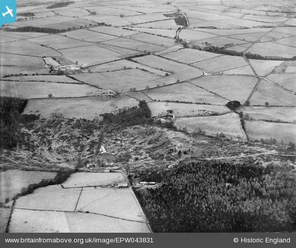
epw043831 ENGLAND (1934). Redwaybanks Wood and Whittonstall Drift Mine, Whittonstall, from the south-west, 1934
© Copyright OpenStreetMap contributors and licensed by the OpenStreetMap Foundation. 2025. Cartography is licensed as CC BY-SA.
Details
| Title | [EPW043831] Redwaybanks Wood and Whittonstall Drift Mine, Whittonstall, from the south-west, 1934 |
| Reference | EPW043831 |
| Date | February-1934 |
| Link | |
| Place name | WHITTONSTALL |
| Parish | SHOTLEY LOW QUARTER |
| District | |
| Country | ENGLAND |
| Easting / Northing | 408849, 557116 |
| Longitude / Latitude | -1.8619665478542, 54.908596272542 |
| National Grid Reference | NZ088571 |
Pins

J May |
Wednesday 3rd of March 2021 10:52:18 AM | |
|
J May |
Wednesday 3rd of March 2021 10:51:43 AM | |
|
J May |
Wednesday 3rd of March 2021 10:50:26 AM | |
|
J May |
Wednesday 3rd of March 2021 10:50:12 AM | |
|
J May |
Wednesday 3rd of March 2021 10:49:35 AM | |
|
J May |
Wednesday 3rd of March 2021 10:48:36 AM | |
|
J May |
Wednesday 3rd of March 2021 10:48:14 AM | |
|
J May |
Wednesday 3rd of March 2021 10:47:26 AM | |
|
J May |
Wednesday 3rd of March 2021 10:46:57 AM |