
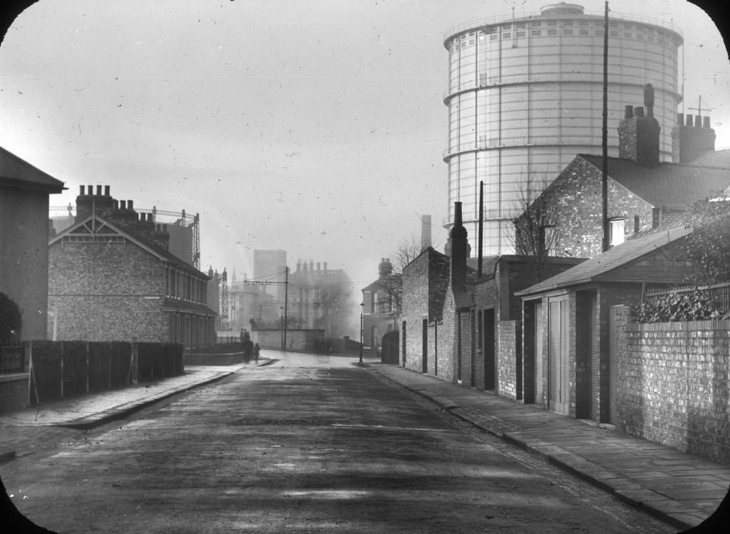
epw042576 ENGLAND (1933). Bradford Road Gas Works (Manchester Corporation), Manchester, 1933

© Copyright OpenStreetMap contributors and licensed by the OpenStreetMap Foundation. 2026. Cartography is licensed as CC BY-SA.
Nearby Images (2)
EPW042576
, Manchester, 1933")
EPW062706

Details
| Title | [EPW042576] Bradford Road Gas Works (Manchester Corporation), Manchester, 1933 |
| Reference | EPW042576 |
| Date | July-1933 |
| Link | |
| Place name | MANCHESTER |
| Parish | |
| District | |
| Country | ENGLAND |
| Easting / Northing | 386263, 398927 |
| Longitude / Latitude | -2.2070479703262, 53.486626939229 |
| National Grid Reference | SJ863989 |
Pins
Tegels |
Wednesday 18th of October 2017 09:00:53 PM | |

Barney Rubble |
Sunday 11th of January 2015 07:13:39 PM |
User Comment Contributions
A fine view across the Bradford Road gas works - at the time Manchester City Council were investing heavily in their gas undertaking, the new works at Partington had formally opened 4 years earlier and the older city centre gas works such as Bradford Road were being altered. This view shows what I think may be the remains of the earlier gas holders to the left - in the 1933 Annual Report of the Council mention is made of a new waterless gas holder at Bradford Road standing 248ft high - I suspect that is the structure casing such a shadow over the cramped houses of Glebe St shown atht he lower edge of the image? |
Mikeya |
Saturday 24th of August 2013 10:37:12 AM |