
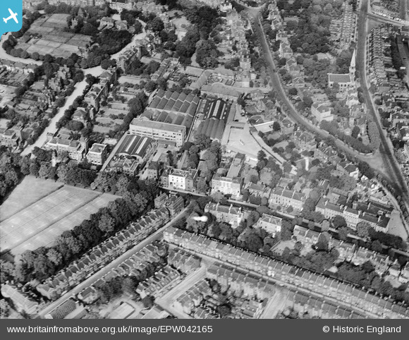
epw042165 ENGLAND (1933). Highbury Grove and works off Aberdeen Lane, Highbury, 1933
© Copyright OpenStreetMap contributors and licensed by the OpenStreetMap Foundation. 2025. Cartography is licensed as CC BY-SA.
Nearby Images (3)
EPW042165

EPW042169

EPW042166

Details
| Title | [EPW042165] Highbury Grove and works off Aberdeen Lane, Highbury, 1933 |
| Reference | EPW042165 |
| Date | July-1933 |
| Link | |
| Place name | HIGHBURY |
| Parish | |
| District | |
| Country | ENGLAND |
| Easting / Northing | 532014, 185161 |
| Longitude / Latitude | -0.095809222119653, 51.54939760383 |
| National Grid Reference | TQ320852 |
Pins

Ian |
Wednesday 8th of February 2023 12:56:59 AM | |
|
Ian |
Wednesday 8th of February 2023 12:56:34 AM | |
|
Ian |
Wednesday 8th of February 2023 12:53:22 AM | |
|
Ian |
Wednesday 8th of February 2023 12:53:04 AM | |
|
Ian |
Wednesday 8th of February 2023 12:52:16 AM | |
|
billyfern |
Saturday 28th of June 2014 04:47:59 PM | |
|
billyfern |
Saturday 28th of June 2014 04:47:29 PM | |
|
billyfern |
Saturday 28th of June 2014 04:30:42 PM | |
|
billyfern |
Saturday 28th of June 2014 04:21:50 PM | |
|
billyfern |
Saturday 28th of June 2014 04:21:18 PM | |
|
billyfern |
Saturday 28th of June 2014 04:20:36 PM | |
|
billyfern |
Saturday 28th of June 2014 04:20:11 PM |