
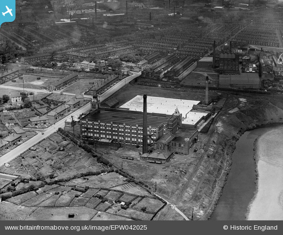
epw042025 ENGLAND (1933). Pilot Cotton Mill and environs, Bury, 1933
© Copyright OpenStreetMap contributors and licensed by the OpenStreetMap Foundation. 2026. Cartography is licensed as CC BY-SA.
Details
| Title | [EPW042025] Pilot Cotton Mill and environs, Bury, 1933 |
| Reference | EPW042025 |
| Date | June-1933 |
| Link | |
| Place name | BURY |
| Parish | |
| District | |
| Country | ENGLAND |
| Easting / Northing | 381283, 410006 |
| Longitude / Latitude | -2.282769859086, 53.586065778925 |
| National Grid Reference | SD813100 |
Pins

1HIve |
Friday 8th of October 2021 04:07:58 PM | |
|
granemill07 |
Tuesday 1st of July 2014 10:43:29 PM | |
|
parrot |
Monday 20th of May 2013 01:32:48 PM | |
|
parrot |
Monday 20th of May 2013 01:32:11 PM |