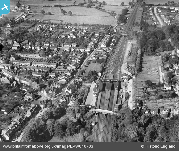
epw040703 ENGLAND (1932). The railway station and environs, Radlett, 1932
© Copyright OpenStreetMap contributors and licensed by the OpenStreetMap Foundation. 2024. Cartography is licensed as CC BY-SA.
Details
| Title | [EPW040703] The railway station and environs, Radlett, 1932 |
| Reference | EPW040703 |
| Date | October-1932 |
| Link | |
| Place name | RADLETT |
| Parish | ALDENHAM |
| District | |
| Country | ENGLAND |
| Easting / Northing | 516371, 199897 |
| Longitude / Latitude | -0.31643969340508, 51.685295346386 |
| National Grid Reference | TQ164999 |
Pins
 RSF |
Wednesday 18th of November 2020 06:48:48 PM | |
 John W |
Friday 22nd of July 2016 09:15:09 PM | |
 John W |
Friday 22nd of July 2016 09:13:55 PM | |
 John W |
Friday 22nd of July 2016 09:13:26 PM | |
 John W |
Friday 22nd of July 2016 09:12:52 PM | |
 John W |
Friday 22nd of July 2016 09:12:08 PM | |
 John W |
Friday 22nd of July 2016 09:11:10 PM | |
 John W |
Friday 22nd of July 2016 09:10:24 PM | |
 John W |
Friday 22nd of July 2016 09:09:03 PM | |
 erwoolley |
Sunday 16th of November 2014 11:05:30 PM | |
 erwoolley |
Sunday 16th of November 2014 11:03:42 PM | |
 erwoolley |
Sunday 16th of November 2014 11:03:07 PM |


![[EPW040703] The railway station and environs, Radlett, 1932](http://britainfromabove.org.uk/sites/all/libraries/aerofilms-images/public/100x100/EPW/040/EPW040703.jpg)
![[EPW040704] The Parade, Radlett, 1932](http://britainfromabove.org.uk/sites/all/libraries/aerofilms-images/public/100x100/EPW/040/EPW040704.jpg)
![[EPW040702] Station Road and environs, Radlett, 1932](http://britainfromabove.org.uk/sites/all/libraries/aerofilms-images/public/100x100/EPW/040/EPW040702.jpg)