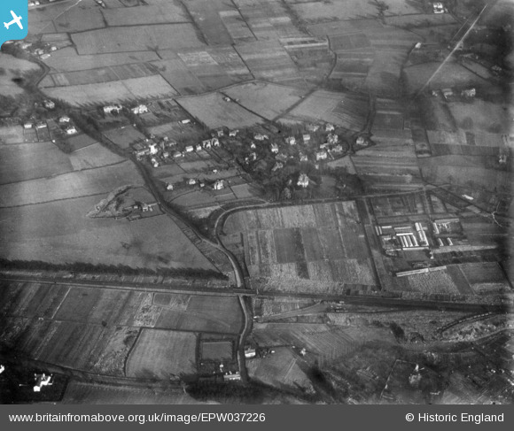
epw037226 ENGLAND (1931). Upton Park, Upton, 1931. This image has been produced from a print.
© Copyright OpenStreetMap contributors and licensed by the OpenStreetMap Foundation. 2024. Cartography is licensed as CC BY-SA.
Details
| Title | [EPW037226] Upton Park, Upton, 1931. This image has been produced from a print. |
| Reference | EPW037226 |
| Date | November-1931 |
| Link | |
| Place name | UPTON |
| Parish | UPTON-BY-CHESTER |
| District | |
| Country | ENGLAND |
| Easting / Northing | 340745, 368495 |
| Longitude / Latitude | -2.8873534979643, 53.209928525348 |
| National Grid Reference | SJ407685 |
Pins
 Bunn72 |
Wednesday 10th of June 2015 11:19:54 AM | |
 Bunn72 |
Wednesday 10th of June 2015 11:13:53 AM | |
 Bunn72 |
Wednesday 10th of June 2015 11:12:45 AM | |
 Bunn72 |
Tuesday 9th of June 2015 08:10:59 PM | |
 Bunn72 |
Tuesday 9th of June 2015 08:09:20 PM | |
 Bunn72 |
Tuesday 9th of June 2015 08:08:07 PM | |
 Bunn72 |
Tuesday 9th of June 2015 08:07:29 PM | |
 Bunn72 |
Tuesday 9th of June 2015 08:07:05 PM | |
 Bunn72 |
Tuesday 9th of June 2015 08:06:29 PM | |
 Bunn72 |
Tuesday 9th of June 2015 08:05:38 PM | |
 Bunn72 |
Tuesday 9th of June 2015 08:04:50 PM | |
 Bunn72 |
Tuesday 9th of June 2015 07:58:39 PM | |
 Bunn72 |
Tuesday 9th of June 2015 07:57:21 PM | |
 Bunn72 |
Tuesday 9th of June 2015 07:55:18 PM | |
 Bunn72 |
Tuesday 9th of June 2015 07:54:36 PM | |
 Martin Wright |
Thursday 8th of January 2015 01:05:23 PM | |
 Martin Wright |
Thursday 8th of January 2015 01:04:28 PM | |
 Martin Wright |
Thursday 8th of January 2015 01:03:33 PM | |
 Martin Wright |
Thursday 8th of January 2015 01:00:04 PM | |
 Martin Wright |
Thursday 8th of January 2015 12:59:08 PM |
User Comment Contributions
Looking to the North East towards railway Mill lane, Upton House, Upton Park Sand pit and plant nursery |
 Martin Wright |
Thursday 8th of January 2015 01:03:12 PM |

