
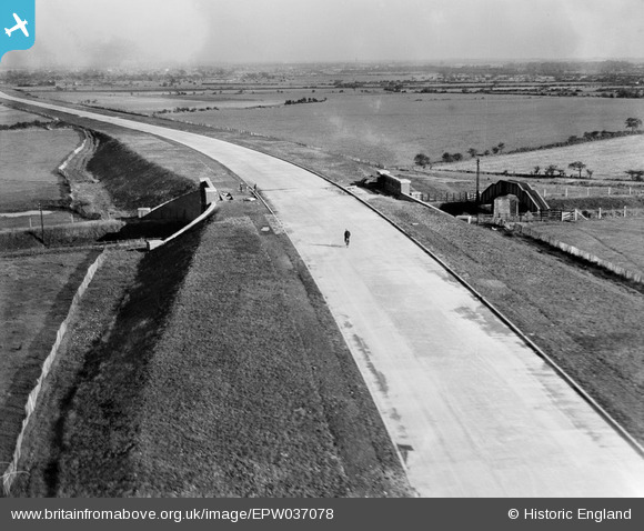
epw037078 ENGLAND (1931). A lone cyclist on the East Lancashire Road (A580), Golborne, from the west, 1931
© Copyright OpenStreetMap contributors and licensed by the OpenStreetMap Foundation. 2025. Cartography is licensed as CC BY-SA.
Nearby Images (2)
EPW037078
, Golborne, from the west, 1931")
EPW037076
 crossing the Wigan Junction Dismantled Railway, Golborne, from the west, 1931")
Details
| Title | [EPW037078] A lone cyclist on the East Lancashire Road (A580), Golborne, from the west, 1931 |
| Reference | EPW037078 |
| Date | October-1931 |
| Link | |
| Place name | GOLBORNE |
| Parish | |
| District | |
| Country | ENGLAND |
| Easting / Northing | 363305, 396951 |
| Longitude / Latitude | -2.5528343892397, 53.467764266265 |
| National Grid Reference | SJ633970 |
Pins
 John W |
Wednesday 4th of August 2021 09:36:50 PM | |
micky |
Saturday 20th of July 2013 10:17:01 AM |