
Scheduled Maintenance
This website will undergo scheduled maintenance on Tuesday, September 10th, between 11:00 and 15:00, as well as on Thursday, September 12th, between 10:00 and 12:00. During this time, services may be temporarily disrupted. We apologise for any inconvenience.
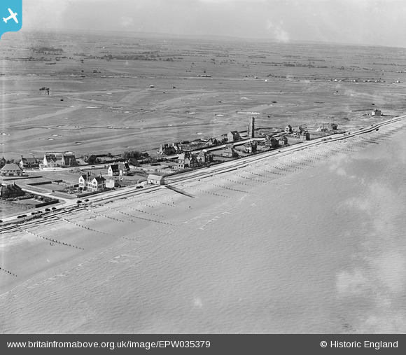
epw035379 ENGLAND (1931). Coast Drive and environs, Littlestone-on-Sea, from the south-east, 1931
© Copyright OpenStreetMap contributors and licensed by the OpenStreetMap Foundation. 2024. Cartography is licensed as CC BY-SA.
Nearby Images (5)
EPW035379

EAW030096

EAW030097

EAW030095

EPW035378

Details
| Title | [EPW035379] Coast Drive and environs, Littlestone-on-Sea, from the south-east, 1931 |
| Reference | EPW035379 |
| Date | 25-May-1931 |
| Link | |
| Place name | LITTLESTONE-ON-SEA |
| Parish | NEW ROMNEY |
| District | |
| Country | ENGLAND |
| Easting / Northing | 608682, 124621 |
| Longitude / Latitude | 0.97341338652606, 50.982572369068 |
| National Grid Reference | TR087246 |
Pins
 John W |
Thursday 8th of September 2016 08:33:20 PM |