
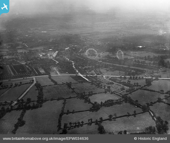
epw034636 ENGLAND (1930). New housing under development around Edgware Way (A41), Edgware, from the north, 1930
© Copyright OpenStreetMap contributors and licensed by the OpenStreetMap Foundation. 2026. Cartography is licensed as CC BY-SA.
Details
| Title | [EPW034636] New housing under development around Edgware Way (A41), Edgware, from the north, 1930 |
| Reference | EPW034636 |
| Date | 16-October-1930 |
| Link | |
| Place name | EDGWARE |
| Parish | |
| District | |
| Country | ENGLAND |
| Easting / Northing | 519338, 193238 |
| Longitude / Latitude | -0.2758095437394, 51.624820150253 |
| National Grid Reference | TQ193932 |
