
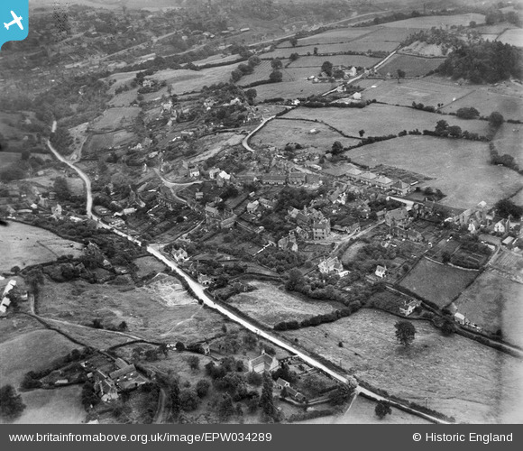
epw034289 ENGLAND (1930). Broseley Wood, Broseley, 1930
© Copyright OpenStreetMap contributors and licensed by the OpenStreetMap Foundation. 2025. Cartography is licensed as CC BY-SA.
Details
| Title | [EPW034289] Broseley Wood, Broseley, 1930 |
| Reference | EPW034289 |
| Date | July-1930 |
| Link | |
| Place name | BROSELEY |
| Parish | BROSELEY |
| District | |
| Country | ENGLAND |
| Easting / Northing | 367084, 302509 |
| Longitude / Latitude | -2.4862547217497, 52.618997354136 |
| National Grid Reference | SJ671025 |
Pins
 |
 TheVintageDoc |
Saturday 1st of February 2014 09:32:15 PM |
lovely pic of grandad x |
jana tareen |
Wednesday 2nd of April 2014 10:26:57 PM |
severnsider |
Monday 29th of July 2013 04:06:44 PM | |
severnsider |
Monday 29th of July 2013 04:06:25 PM | |
severnsider |
Monday 29th of July 2013 04:05:56 PM | |
severnsider |
Monday 29th of July 2013 04:05:39 PM | |
severnsider |
Monday 29th of July 2013 04:05:18 PM | |
severnsider |
Monday 29th of July 2013 04:05:00 PM | |
severnsider |
Monday 29th of July 2013 04:04:46 PM | |
severnsider |
Monday 29th of July 2013 04:04:28 PM | |
severnsider |
Monday 29th of July 2013 04:04:12 PM | |
severnsider |
Monday 29th of July 2013 04:03:40 PM | |
severnsider |
Monday 29th of July 2013 04:03:15 PM | |
severnsider |
Monday 29th of July 2013 04:02:53 PM | |
severnsider |
Monday 29th of July 2013 04:02:14 PM |