
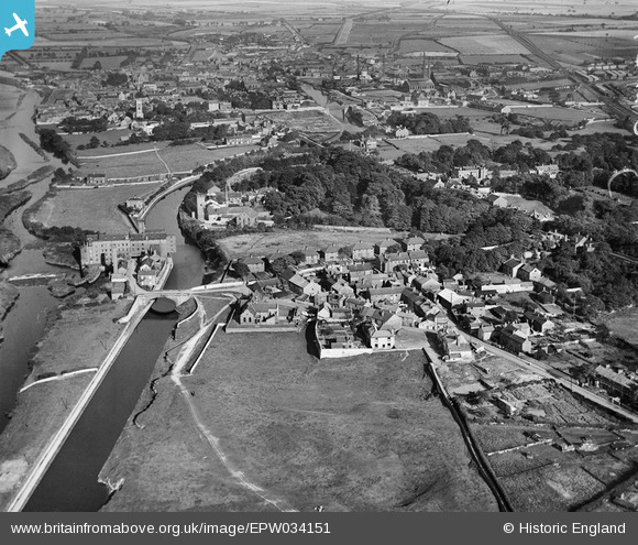
epw034151 ENGLAND (1930). Mill Bridge, the Knottingley and Goole Canal and the town, Knottingley, from the west, 1930
© Copyright OpenStreetMap contributors and licensed by the OpenStreetMap Foundation. 2025. Cartography is licensed as CC BY-SA.
Details
| Title | [EPW034151] Mill Bridge, the Knottingley and Goole Canal and the town, Knottingley, from the west, 1930 |
| Reference | EPW034151 |
| Date | July-1930 |
| Link | |
| Place name | KNOTTINGLEY |
| Parish | |
| District | |
| Country | ENGLAND |
| Easting / Northing | 449177, 424029 |
| Longitude / Latitude | -1.2548616981059, 53.710138955693 |
| National Grid Reference | SE492240 |
Pins

dyey |
Tuesday 11th of November 2014 08:34:33 PM | |

Cabby |
Sunday 23rd of February 2014 01:20:57 PM | |
|
Cabby |
Sunday 23rd of February 2014 01:18:30 PM | |
|
Cabby |
Sunday 23rd of February 2014 01:14:15 PM | |
|
Cabby |
Sunday 23rd of February 2014 01:13:25 PM | |
|
MB |
Tuesday 3rd of December 2013 10:44:56 AM | |

Derekdye |
Monday 14th of January 2013 09:33:34 PM | |
|
Derekdye |
Monday 14th of January 2013 09:30:37 PM | |
|
Derekdye |
Monday 14th of January 2013 09:29:41 PM |