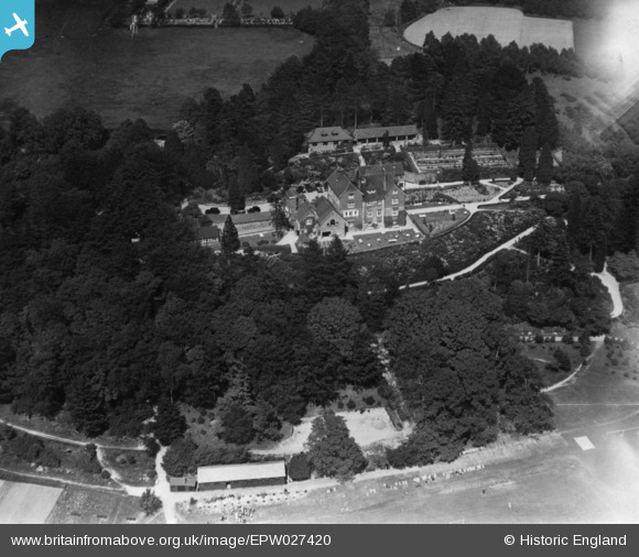
epw027420 ENGLAND (1929). Fernden School, Kingsley Green, 1929. This image has been produced from a print.
© Copyright OpenStreetMap contributors and licensed by the OpenStreetMap Foundation. 2025. Cartography is licensed as CC BY-SA.
Nearby Images (7)
Details
| Title | [EPW027420] Fernden School, Kingsley Green, 1929. This image has been produced from a print. |
| Reference | EPW027420 |
| Date | May-1929 |
| Link | |
| Place name | KINGSLEY GREEN |
| Parish | FERNHURST |
| District | |
| Country | ENGLAND |
| Easting / Northing | 489929, 130899 |
| Longitude / Latitude | -0.7163318058586, 51.069834461436 |
| National Grid Reference | SU899309 |
Pins
Be the first to add a comment to this image!


![[EPW027420] Fernden School, Kingsley Green, 1929. This image has been produced from a print.](http://britainfromabove.org.uk/sites/all/libraries/aerofilms-images/public/100x100/EPW/027/EPW027420.jpg)
![[EPW027423] Fernden School, Kingsley Green, 1929](http://britainfromabove.org.uk/sites/all/libraries/aerofilms-images/public/100x100/EPW/027/EPW027423.jpg)
![[EPW027421] Fernden School and Sports Field, Kingsley Green, 1929](http://britainfromabove.org.uk/sites/all/libraries/aerofilms-images/public/100x100/EPW/027/EPW027421.jpg)
![[EPW027425] Fernden School and environs, Kingsley Green, 1929](http://britainfromabove.org.uk/sites/all/libraries/aerofilms-images/public/100x100/EPW/027/EPW027425.jpg)
![[EPW027418] Fernden School and Sports Field, Kingsley Green, 1929](http://britainfromabove.org.uk/sites/all/libraries/aerofilms-images/public/100x100/EPW/027/EPW027418.jpg)
![[EPW027426] Fernden School and Sports Field, Kingsley Green, 1929](http://britainfromabove.org.uk/sites/all/libraries/aerofilms-images/public/100x100/EPW/027/EPW027426.jpg)
![[EPW027417] Fernden School Sports Field, Kingsley Green, 1929](http://britainfromabove.org.uk/sites/all/libraries/aerofilms-images/public/100x100/EPW/027/EPW027417.jpg)