
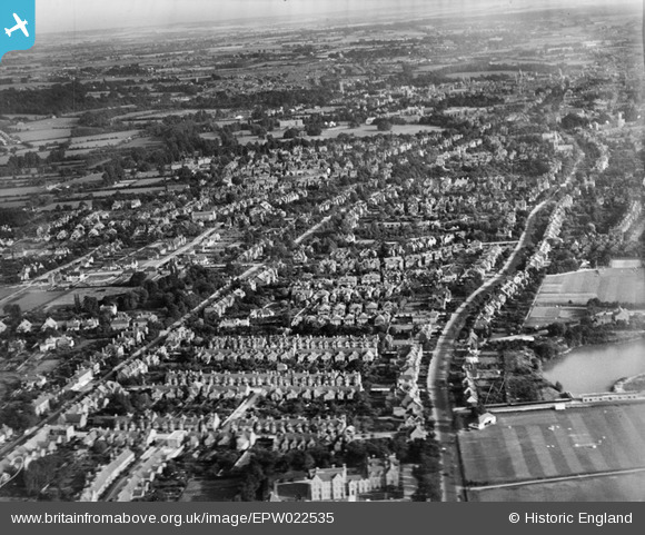
epw022535 ENGLAND (1928). Park Town and environs, Oxford, from the north, 1928
© Copyright OpenStreetMap contributors and licensed by the OpenStreetMap Foundation. 2024. Cartography is licensed as CC BY-SA.
Nearby Images (2)
EPW022535

EPW031317
 by Woodstock Road and St John's College Sports Ground, Oxford, 1930")
Details
| Title | [EPW022535] Park Town and environs, Oxford, from the north, 1928 |
| Reference | EPW022535 |
| Date | 11-August-1928 |
| Link | |
| Place name | OXFORD |
| Parish | |
| District | |
| Country | ENGLAND |
| Easting / Northing | 450691, 208733 |
| Longitude / Latitude | -1.2652185121123, 51.774518043727 |
| National Grid Reference | SP507087 |
Pins
 Ray |
Thursday 30th of September 2021 07:10:32 AM | |
Salisian |
Monday 7th of October 2019 02:01:42 PM | |
Clare D |
Wednesday 14th of November 2012 03:35:58 PM | |
Yes, this looks like the large terraces on the south and north sides of Park Town. This is one of the most desirable addresses in the city. There is a third terrace along the back (east), with an elevated walkway to the front doors of each house. |
Taube |
Thursday 7th of March 2013 03:37:02 PM |