
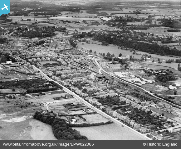
epw022366 ENGLAND (1928). The town around Ware Road and Hertford East Station, Hertford, from the east, 1928
© Copyright OpenStreetMap contributors and licensed by the OpenStreetMap Foundation. 2025. Cartography is licensed as CC BY-SA.
Details
| Title | [EPW022366] The town around Ware Road and Hertford East Station, Hertford, from the east, 1928 |
| Reference | EPW022366 |
| Date | August-1928 |
| Link | |
| Place name | HERTFORD |
| Parish | HERTFORD |
| District | |
| Country | ENGLAND |
| Easting / Northing | 533618, 212941 |
| Longitude / Latitude | -0.062057056582833, 51.798682178041 |
| National Grid Reference | TL336129 |
Pins
 JohnW |
Saturday 8th of October 2022 07:05:26 PM | |
John W |
Sunday 31st of July 2016 07:35:17 PM | |
Three Hornby Wagons |
Thursday 20th of February 2014 08:47:33 PM | |
Nick G |
Sunday 20th of October 2013 07:37:55 PM | |
Nick G |
Sunday 20th of October 2013 07:37:01 PM | |
Nick G |
Sunday 20th of October 2013 07:36:02 PM | |
Nick G |
Sunday 20th of October 2013 07:35:42 PM | |
Nick G |
Sunday 20th of October 2013 07:33:57 PM | |
Valerie |
Saturday 31st of August 2013 11:44:05 PM | |
Jeremy |
Monday 25th of June 2012 11:42:11 PM |
User Comment Contributions
You can just see Christs Hospital school for girls in the bottom of the top left quadrant |
Valerie |
Saturday 31st of August 2013 11:30:37 PM |