
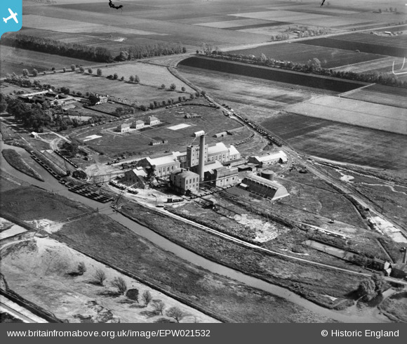
epw021532 ENGLAND (1928). Wissington Sugar Factory, Methwold, 1928
© Copyright OpenStreetMap contributors and licensed by the OpenStreetMap Foundation. 2025. Cartography is licensed as CC BY-SA.
Nearby Images (2)
EPW021532

EPW021533

Details
| Title | [EPW021532] Wissington Sugar Factory, Methwold, 1928 |
| Reference | EPW021532 |
| Date | June-1928 |
| Link | |
| Place name | METHWOLD |
| Parish | METHWOLD |
| District | |
| Country | ENGLAND |
| Easting / Northing | 566111, 297662 |
| Longitude / Latitude | 0.45028543242627, 52.551057024047 |
| National Grid Reference | TL661977 |
Pins
 Wissey |
Thursday 20th of July 2023 11:16:22 AM | |
Wissey |
Sunday 12th of September 2021 08:47:04 PM | |
Wissey |
Wednesday 14th of April 2021 05:52:42 PM | |
Wissey |
Wednesday 17th of March 2021 12:18:14 PM | |
Wissey |
Wednesday 17th of March 2021 12:15:47 PM | |
Wissey |
Wednesday 17th of March 2021 12:14:03 PM |