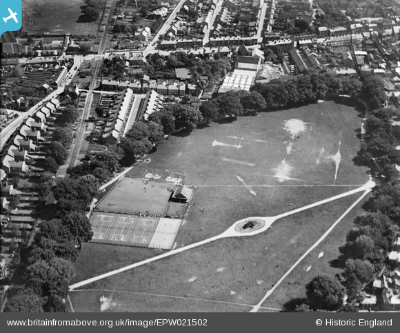
epw021502 ENGLAND (1928). Wisbech Park and Recreation Ground, Wisbech, 1928
© Copyright OpenStreetMap contributors and licensed by the OpenStreetMap Foundation. 2025. Cartography is licensed as CC BY-SA.
Details
| Title | [EPW021502] Wisbech Park and Recreation Ground, Wisbech, 1928 |
| Reference | EPW021502 |
| Date | June-1928 |
| Link | |
| Place name | WISBECH |
| Parish | WISBECH |
| District | |
| Country | ENGLAND |
| Easting / Northing | 546588, 309771 |
| Longitude / Latitude | 0.16791041481126, 52.665457173826 |
| National Grid Reference | TF466098 |
Pins
 Gugnunk |
Thursday 20th of February 2014 12:33:09 PM | |
 hometown |
Wednesday 10th of April 2013 04:43:13 PM | |
That's interesting, I had not heard of this before. |
 Peter |
Friday 3rd of May 2013 08:04:02 PM |
 hometown |
Wednesday 10th of April 2013 04:41:52 PM | |
 hometown |
Wednesday 10th of April 2013 04:36:50 PM | |
 hometown |
Wednesday 10th of April 2013 04:35:26 PM | |
 Richard Humphrey |
Monday 25th of March 2013 07:49:30 AM | |
 Richard Humphrey |
Monday 25th of March 2013 07:48:37 AM | |
 Richard Humphrey |
Monday 25th of March 2013 07:47:50 AM | |
Branch of the Great Eastern Railway from near Wisbech East station. |
 John W |
Tuesday 7th of February 2017 08:13:35 PM |
 Richard Humphrey |
Monday 25th of March 2013 07:47:07 AM |

