
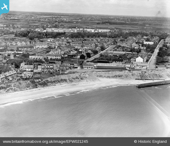
epw021245 ENGLAND (1928). Pakefield Cliffs and the town, Kirkley, from the south-east, 1928
© Copyright OpenStreetMap contributors and licensed by the OpenStreetMap Foundation. 2025. Cartography is licensed as CC BY-SA.
Details
| Title | [EPW021245] Pakefield Cliffs and the town, Kirkley, from the south-east, 1928 |
| Reference | EPW021245 |
| Date | May-1928 |
| Link | |
| Place name | KIRKLEY |
| Parish | |
| District | |
| Country | ENGLAND |
| Easting / Northing | 654137, 290781 |
| Longitude / Latitude | 1.7410034044403, 52.455368452666 |
| National Grid Reference | TM541908 |
Pins
 Brightonboy |
Monday 30th of June 2014 07:04:44 AM | |
Brightonboy |
Saturday 4th of January 2014 09:58:17 PM | |
Brightonboy |
Saturday 4th of January 2014 09:57:33 PM | |
Mel Culley |
Monday 23rd of December 2013 11:31:33 PM | |
Mel Culley |
Monday 23rd of December 2013 11:31:00 PM | |
Mel Culley |
Monday 23rd of December 2013 11:30:15 PM | |
Brightonboy |
Monday 7th of October 2013 08:41:00 PM | |
Brightonboy |
Monday 7th of October 2013 08:40:32 PM |