
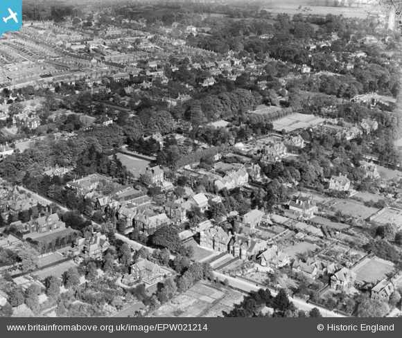
epw021214 ENGLAND (1928). Mount Pleasant, Norwich, 1928
© Copyright OpenStreetMap contributors and licensed by the OpenStreetMap Foundation. 2026. Cartography is licensed as CC BY-SA.
Details
| Title | [EPW021214] Mount Pleasant, Norwich, 1928 |
| Reference | EPW021214 |
| Date | May-1928 |
| Link | |
| Place name | NORWICH |
| Parish | |
| District | |
| Country | ENGLAND |
| Easting / Northing | 621663, 307536 |
| Longitude / Latitude | 1.2750634980843, 52.619909795579 |
| National Grid Reference | TG217075 |
Pins

Karen |
Wednesday 3rd of September 2025 11:58:31 AM | |
|
Karen |
Wednesday 3rd of September 2025 11:55:13 AM | |
|
Andrew Wenley |
Wednesday 11th of April 2018 12:29:15 PM | |
|
Andrew Wenley |
Wednesday 11th of April 2018 12:27:06 PM | |
|
Andrew Wenley |
Wednesday 11th of April 2018 12:25:26 PM | |

Class31 |
Tuesday 4th of September 2012 09:29:11 PM | |
|
Class31 |
Tuesday 4th of September 2012 09:23:14 PM | |
Verity Hancock |
Wednesday 30th of May 2012 04:20:38 PM | |
I'm afraid you won't thank me but this is Unthank Road. |
Class31 |
Tuesday 4th of September 2012 09:24:50 PM |
User Comment Contributions
View looking east. |
Class31 |
Tuesday 4th of September 2012 09:33:41 PM |