
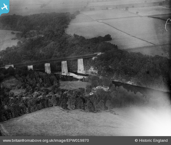
epw019870 ENGLAND (1927). The Tees Railway Viaduct, Barnard Castle, 1927
© Copyright OpenStreetMap contributors and licensed by the OpenStreetMap Foundation. 2026. Cartography is licensed as CC BY-SA.
Details
| Title | [EPW019870] The Tees Railway Viaduct, Barnard Castle, 1927 |
| Reference | EPW019870 |
| Date | October-1927 |
| Link | |
| Place name | BARNARD CASTLE |
| Parish | MARWOOD |
| District | |
| Country | ENGLAND |
| Easting / Northing | 404026, 517501 |
| Longitude / Latitude | -1.9377474659197, 54.552614117471 |
| National Grid Reference | NZ040175 |
Pins
Be the first to add a comment to this image!
User Comment Contributions
Demolished after the railway lines using it closed in the 1960s. |

John W |
Wednesday 3rd of August 2016 08:50:26 PM |