
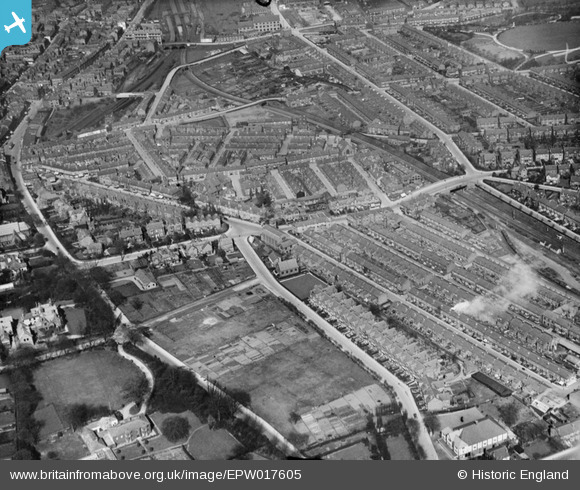
epw017605 ENGLAND (1927). Hale Road and environs, Altrincham, 1927
© Copyright OpenStreetMap contributors and licensed by the OpenStreetMap Foundation. 2026. Cartography is licensed as CC BY-SA.
Details
| Title | [EPW017605] Hale Road and environs, Altrincham, 1927 |
| Reference | EPW017605 |
| Date | April-1927 |
| Link | |
| Place name | ALTRINCHAM |
| Parish | |
| District | |
| Country | ENGLAND |
| Easting / Northing | 376820, 387258 |
| Longitude / Latitude | -2.3485140048838, 53.381398412739 |
| National Grid Reference | SJ768873 |
Pins

John Ellis |
Tuesday 21st of October 2014 11:45:50 AM | |
|
Freefall |
Wednesday 28th of May 2014 03:05:53 PM | |
|
FermePark |
Thursday 14th of March 2013 06:13:27 PM | |
|
Mike |
Thursday 30th of August 2012 07:16:25 PM | |
|
John Ellis |
Tuesday 31st of July 2012 11:31:21 PM | |
|
John Ellis |
Tuesday 31st of July 2012 11:30:33 PM | |
|
John Ellis |
Tuesday 31st of July 2012 11:28:05 PM | |
|
John Ellis |
Tuesday 31st of July 2012 11:27:09 PM | |
|
John Ellis |
Tuesday 31st of July 2012 11:25:55 PM | |
|
John Ellis |
Tuesday 31st of July 2012 11:24:47 PM | |
|
John Ellis |
Tuesday 31st of July 2012 11:23:27 PM | |
|
John Ellis |
Tuesday 31st of July 2012 11:22:37 PM | |
|
John Ellis |
Tuesday 31st of July 2012 11:21:56 PM | |
|
John Ellis |
Tuesday 31st of July 2012 11:21:22 PM | |
|
John Ellis |
Tuesday 31st of July 2012 11:19:39 PM | |
|
John Ellis |
Tuesday 31st of July 2012 11:18:47 PM | |
|
John Ellis |
Tuesday 31st of July 2012 11:17:00 PM | |
|
John Ellis |
Tuesday 31st of July 2012 11:16:12 PM | |
|
John Ellis |
Tuesday 31st of July 2012 11:15:39 PM | |
|
John Ellis |
Tuesday 31st of July 2012 11:14:21 PM | |
|
John Ellis |
Tuesday 31st of July 2012 11:12:27 PM | |
|
John Ellis |
Tuesday 31st of July 2012 11:11:47 PM | |
|
John Ellis |
Tuesday 31st of July 2012 11:09:45 PM | |
Area off Lloyd Street where Sainsburys is now and the blocks of flats next to the railway bridge was known as Calais due to a large no. of French labourers living there - employed in canal building. |
mickeydripping |
Monday 22nd of April 2013 10:06:58 AM |
|
John Ellis |
Tuesday 31st of July 2012 11:05:16 PM | |
|
John Ellis |
Tuesday 31st of July 2012 11:04:22 PM | |
|
John Ellis |
Tuesday 31st of July 2012 11:03:27 PM | |
|
John Ellis |
Tuesday 31st of July 2012 11:02:34 PM | |
Originally Bowdn Station. Altrincham station was separate and where the level crossing used to be nearer Manchester. Present station was new and named Altruncham and Bowdon. |
Maxonian206 |
Monday 1st of February 2016 10:13:49 AM |
|
John Ellis |
Tuesday 31st of July 2012 11:00:16 PM | |
|
John Ellis |
Tuesday 31st of July 2012 10:59:47 PM | |
|
John Ellis |
Tuesday 31st of July 2012 10:59:04 PM | |
Two trams visible. Presumably one on the 47 and one on the 48 routes. |
Maxonian206 |
Monday 1st of February 2016 10:14:49 AM |
|
John Ellis |
Tuesday 31st of July 2012 10:56:32 PM | |
|
John Ellis |
Tuesday 31st of July 2012 10:55:33 PM | |
|
John Ellis |
Tuesday 31st of July 2012 10:54:57 PM |