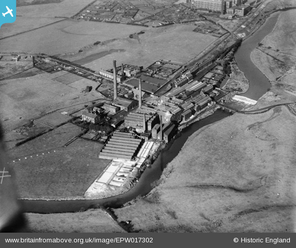
epw017302 ENGLAND (1926). The Gigg Paper Mill, Bury, 1926
© Copyright OpenStreetMap contributors and licensed by the OpenStreetMap Foundation. 2025. Cartography is licensed as CC BY-SA.
Details
| Title | [EPW017302] The Gigg Paper Mill, Bury, 1926 |
| Reference | EPW017302 |
| Date | October-1926 |
| Link | |
| Place name | BURY |
| Parish | |
| District | |
| Country | ENGLAND |
| Easting / Northing | 381383, 409445 |
| Longitude / Latitude | -2.2812256380632, 53.581026383092 |
| National Grid Reference | SD814094 |
Pins
 Ian Taylor |
Thursday 14th of September 2017 02:05:14 PM | |
 driverhire3 |
Wednesday 9th of December 2015 03:12:18 PM | |
 driverhire3 |
Wednesday 9th of December 2015 03:10:12 PM | |
 driverhire3 |
Wednesday 9th of December 2015 03:09:27 PM |

