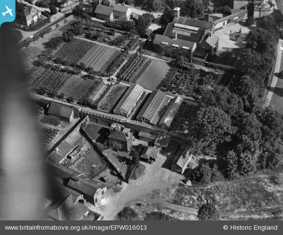
epw016013 ENGLAND (1926). The gardens and glasshouses at Carpenders Park, Carpenders Park, 1926
© Copyright OpenStreetMap contributors and licensed by the OpenStreetMap Foundation. 2024. Cartography is licensed as CC BY-SA.
Details
| Title | [EPW016013] The gardens and glasshouses at Carpenders Park, Carpenders Park, 1926 |
| Reference | EPW016013 |
| Date | 1-July-1926 |
| Link | |
| Place name | CARPENDERS PARK |
| Parish | WATFORD RURAL |
| District | |
| Country | ENGLAND |
| Easting / Northing | 512602, 193475 |
| Longitude / Latitude | -0.37301125298821, 51.628338970198 |
| National Grid Reference | TQ126935 |
Pins
 ordinarybloke |
Thursday 21st of November 2024 10:07:54 PM | |
 ordinarybloke |
Sunday 19th of January 2020 11:51:43 PM | |
 Neil Hamilton |
Saturday 24th of March 2018 12:22:41 AM | |
 Arthur Hall |
Wednesday 14th of January 2015 07:22:06 PM | |
 Neil Hamilton |
Wednesday 4th of December 2013 10:15:00 PM | |
 Neil Hamilton |
Wednesday 4th of December 2013 08:34:26 PM | |
 Neil Hamilton |
Wednesday 4th of December 2013 08:32:50 PM | |
This house was occupied by the Watt's Family, and the address was Known as Gardeners cottage Highfields. Bothy Cottage was occupied by The Morgan Family, and is at the bottom left of the picture, and is not very clear. |
 Arthur Hall |
Wednesday 14th of January 2015 07:27:27 PM |
 Neil Hamilton |
Wednesday 4th of December 2013 08:30:18 PM | |
 Graeme |
Saturday 30th of November 2013 07:52:04 AM | |
Yes, this is Carpenders Farm - confirmed - been looking for an aerial shot of this area for ages |
 Neil Hamilton |
Wednesday 4th of December 2013 08:12:10 PM |
This house which is situated next to the entrance into Brazier's Dairy on the right. was occupied by the 'Land Girls' in the 1940s, and had a Milk Parlour situated at the end of the property. To the left of the picture, and out of sight is another entrance, which was the main entrance to Carpenders Park Farm, and at that period, was separated from Brazier's by a wall, Both were run separately by different owners. |
 Arthur Hall |
Wednesday 14th of January 2015 07:41:12 PM |
 Graeme |
Saturday 30th of November 2013 07:50:13 AM | |
 nkingdon |
Saturday 9th of November 2013 03:03:06 AM | |
 nkingdon |
Saturday 9th of November 2013 03:02:10 AM | |
 Chris Willis |
Monday 22nd of October 2012 12:56:04 PM | |
More likely coach house and stables, it's right next to the pull-in for carriages. Therefore also more likely a clock tower, common on coach houses. |
 Tiny Tim |
Thursday 8th of November 2012 05:38:11 AM |
 scrapemedic |
Saturday 25th of August 2012 08:21:35 PM | |
 chiffchaffbirdy |
Wednesday 18th of July 2012 04:04:19 PM | |
 Eton Slaphead |
Monday 9th of July 2012 09:49:07 PM | |
The house was in use as a high class girls school at the time the pic was taken - I used to know the head gardeners son - he would have been chuffed to see this image |
 Neil Hamilton |
Wednesday 4th of December 2013 08:23:10 PM |
User Comment Contributions
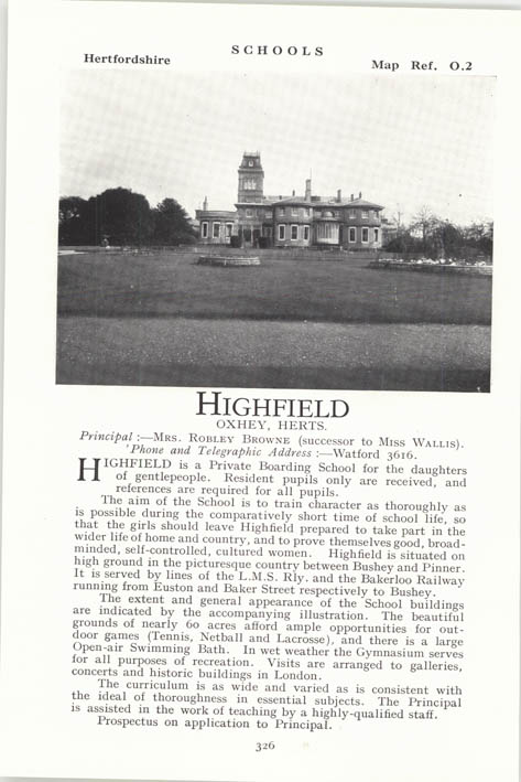 Highfield School Oxhey |
 ordinarybloke |
Monday 30th of March 2015 10:34:45 PM |
Thanks for all the detail and extra information everyone! We'll update the catalogue and post the new data here in due course. Yours, Katy Britain from Above Cataloguing Team Leader |
Katy Whitaker |
Wednesday 8th of January 2014 09:10:23 AM |
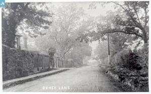
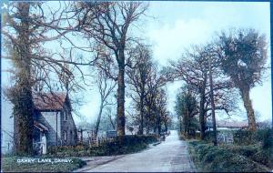
Definitely Highfield girls school, formerly Carpenders situated in Oxhey Lane, Carpenders Park. Demolished 1960. Mansion is just out of view to the right with the old stables, later used as mainhall and ballroom linked by that covered passageway. The house lower just to the right of the angled wall - lower leftwas the gardeners cottage - I knew the people that lived there during the war. Entrance lodge is opposite the farm on the other side of the road. There was another entrance lodge further along Oxhey lane towards Harrow. It was in use at this time as a sick bay for the school |
 Neil Hamilton |
Wednesday 4th of December 2013 08:20:20 PM |
Everything fits for Carpenders Park. The house in Oxhey Lane is still there. The main house and gardens can be seen on the 1934 1:2500 Ordnance Survey map. Well done Graeme. |
 Class31 |
Wednesday 4th of December 2013 08:15:06 PM |
Yep, well spotted - uve been studying the local history of the area for years. I have the aerial survey images - this is the best low alltitude oblique shot ive seen - didnt realise the grounds and kitchen garden were so crowded in |
 Neil Hamilton |
Wednesday 4th of December 2013 08:15:06 PM |
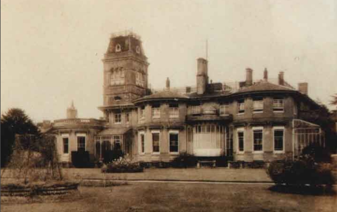 I suspect that this is a view of Highfield School, Watford from the NW. Formally known as Carpender Mansion, it became a school and was demolished in 1959. The flat roofed single story seen on the left of the attched pic seems to match the building in the top right of the photo. |
 Graeme |
Wednesday 4th of December 2013 08:13:24 PM |
Yep, this definitely Highfield school, the old Carpenders mansion - well spotted. I have the original of the pic youve posted |
 Neil Hamilton |
Wednesday 4th of December 2013 08:13:24 PM |
View is looking south. |
 Class31 |
Saturday 30th of November 2013 08:20:32 AM |
I believe this shows the grounds of Shenley Hospital (Mental Asylum) just outside Radlett. Now private housing estate. |
 les |
Thursday 9th of May 2013 12:03:35 AM |
The problem is that the hospital opened in 1934, and building work only started in 1931 (e.g. see http://ezitis.myzen.co.uk/shenley.html), 5 years after this photo was taken. |
 Tony D |
Thursday 9th of May 2013 12:03:35 AM |
The next picture EPW016014 is of Elstree - Aldenham Reservoir |
 Maurice |
Sunday 28th of October 2012 10:23:51 AM |
The whole place (with the probable exception of the foreground) is a strange mixture of decoration and practical. The possible chapel and the neighbouring building, with perhaps another bell, add to the probability of a religous community. |
 Chris Willis |
Monday 22nd of October 2012 12:58:41 PM |

