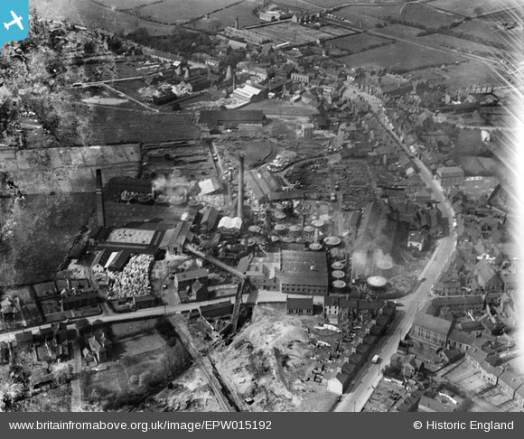
epw015192 ENGLAND (1926). The Anchor Brick and Pipe Works, Swadlincote, 1926
© Copyright OpenStreetMap contributors and licensed by the OpenStreetMap Foundation. 2025. Cartography is licensed as CC BY-SA.
Nearby Images (12)
Details
| Title | [EPW015192] The Anchor Brick and Pipe Works, Swadlincote, 1926 |
| Reference | EPW015192 |
| Date | 13-April-1926 |
| Link | |
| Place name | SWADLINCOTE |
| Parish | |
| District | |
| Country | ENGLAND |
| Easting / Northing | 430096, 319476 |
| Longitude / Latitude | -1.5538501252526, 52.771701260597 |
| National Grid Reference | SK301195 |
Pins
 hunter74 |
Wednesday 29th of October 2014 09:58:28 PM | |
 hunter74 |
Wednesday 29th of October 2014 09:56:24 PM | |
 hunter74 |
Wednesday 29th of October 2014 09:55:40 PM | |
 hunter74 |
Wednesday 29th of October 2014 09:54:30 PM | |
 hunter74 |
Wednesday 29th of October 2014 09:53:36 PM | |
 hunter74 |
Wednesday 29th of October 2014 09:52:42 PM | |
 hunter74 |
Wednesday 29th of October 2014 09:51:46 PM |


![[EPW015192] The Anchor Brick and Pipe Works, Swadlincote, 1926](http://britainfromabove.org.uk/sites/all/libraries/aerofilms-images/public/100x100/EPW/015/EPW015192.jpg)
![[EPW015198] The Anchor Brick and Pipe Works, Swadlincote, 1926](http://britainfromabove.org.uk/sites/all/libraries/aerofilms-images/public/100x100/EPW/015/EPW015198.jpg)
![[EPW015197] The Anchor Brick and Pipe Works, Swadlincote, 1926](http://britainfromabove.org.uk/sites/all/libraries/aerofilms-images/public/100x100/EPW/015/EPW015197.jpg)
![[EPW015190] The Anchor Brick and Pipe Works, Swadlincote, 1926](http://britainfromabove.org.uk/sites/all/libraries/aerofilms-images/public/100x100/EPW/015/EPW015190.jpg)
![[EPW060170] The Anchor Brick and Pipe Works, Swadlincote, 1938](http://britainfromabove.org.uk/sites/all/libraries/aerofilms-images/public/100x100/EPW/060/EPW060170.jpg)
![[EPW060171] Church Street, Coppice Side and the Anchor Brick and Pipe Works, Swadlincote, 1938](http://britainfromabove.org.uk/sites/all/libraries/aerofilms-images/public/100x100/EPW/060/EPW060171.jpg)
![[EPW060173] The Anchor Brick and Pipe Works, Swadlincote, 1938](http://britainfromabove.org.uk/sites/all/libraries/aerofilms-images/public/100x100/EPW/060/EPW060173.jpg)
![[EPW060172] Church Street, Coppice Side and the Anchor Brick and Pipe Works, Swadlincote, 1938](http://britainfromabove.org.uk/sites/all/libraries/aerofilms-images/public/100x100/EPW/060/EPW060172.jpg)
![[EPW060168] The Anchor Brick and Pipe Works, Swadlincote, 1938](http://britainfromabove.org.uk/sites/all/libraries/aerofilms-images/public/100x100/EPW/060/EPW060168.jpg)
![[EPW015193] The Anchor Brick and Pipe Works and environs, Swadlincote, 1926](http://britainfromabove.org.uk/sites/all/libraries/aerofilms-images/public/100x100/EPW/015/EPW015193.jpg)
![[EPW015191] Sanitary Pipe Works off Hill Street, Swadlincote, 1926](http://britainfromabove.org.uk/sites/all/libraries/aerofilms-images/public/100x100/EPW/015/EPW015191.jpg)
![[EPW015194] The Anchor Brick and Pipe Works and environs, Swadlincote, 1926](http://britainfromabove.org.uk/sites/all/libraries/aerofilms-images/public/100x100/EPW/015/EPW015194.jpg)