
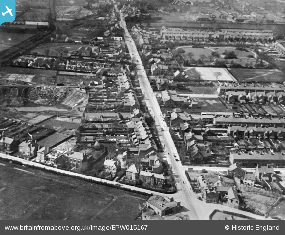
epw015167 ENGLAND (1926). London Road, Coalville, 1926. This image has been produced from a copy-negative.
© Copyright OpenStreetMap contributors and licensed by the OpenStreetMap Foundation. 2025. Cartography is licensed as CC BY-SA.
Nearby Images (2)
EPW015167

EPW015169

Details
| Title | [EPW015167] London Road, Coalville, 1926. This image has been produced from a copy-negative. |
| Reference | EPW015167 |
| Date | 13-April-1926 |
| Link | |
| Place name | COALVILLE |
| Parish | |
| District | |
| Country | ENGLAND |
| Easting / Northing | 443141, 313950 |
| Longitude / Latitude | -1.3612061854647, 52.721137559875 |
| National Grid Reference | SK431140 |


