
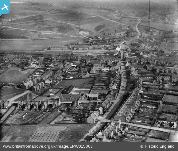
epw015003 ENGLAND (1926). Green Heath Road and environs, Hednesford, 1926
© Copyright OpenStreetMap contributors and licensed by the OpenStreetMap Foundation. 2026. Cartography is licensed as CC BY-SA.
Nearby Images (2)
EPW015003

EPW015005

Details
| Title | [EPW015003] Green Heath Road and environs, Hednesford, 1926 |
| Reference | EPW015003 |
| Date | April-1926 |
| Link | |
| Place name | HEDNESFORD |
| Parish | HEDNESFORD |
| District | |
| Country | ENGLAND |
| Easting / Northing | 399865, 312680 |
| Longitude / Latitude | -2.0019985064937, 52.711439880905 |
| National Grid Reference | SJ999127 |
Pins

Pye Green Lad |
Thursday 7th of January 2016 11:36:27 AM | |
|
Pye Green Lad |
Thursday 7th of January 2016 11:21:54 AM | |
|
Pye Green Lad |
Thursday 7th of January 2016 11:17:42 AM | |
|
Pye Green Lad |
Thursday 7th of January 2016 11:07:33 AM | |
|
Pye Green Lad |
Thursday 7th of January 2016 11:05:56 AM | |
|
Pye Green Lad |
Thursday 7th of January 2016 11:02:55 AM | |
|
hednesfordbloke |
Tuesday 30th of December 2014 03:41:23 PM | |
|
hednesfordbloke |
Tuesday 30th of December 2014 03:39:44 PM | |
This superstore is Tesco and exists today but does not appear in this photograph. |
tezzer |
Sunday 21st of June 2015 08:04:25 PM |
|
hednesfordbloke |
Tuesday 30th of December 2014 03:36:03 PM | |
|
hednesfordbloke |
Tuesday 30th of December 2014 03:33:05 PM | |
|
hednesfordbloke |
Tuesday 30th of December 2014 03:31:55 PM | |
|
hednesfordbloke |
Tuesday 30th of December 2014 03:30:38 PM |
User Comment Contributions
You can see West Hill Primary School, this view is looking down the Greenheath road towards Hednesford. I remember the road/path leading off Greenheath Rd towards the right being called the Skelly Road by some localls in the 70's-80's |
SteveB |
Tuesday 26th of June 2012 03:40:04 PM |