
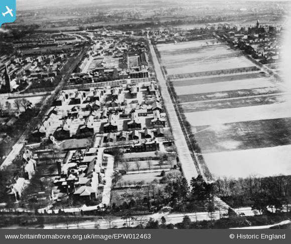
epw012463 ENGLAND (1925). Gibralter Barracks, Steeles Road and Stanhope Lines (Montgomery Lines), Aldershot, 1925. This image has been produced from a copy-negative.
© Copyright OpenStreetMap contributors and licensed by the OpenStreetMap Foundation. 2025. Cartography is licensed as CC BY-SA.
Details
| Title | [EPW012463] Gibralter Barracks, Steeles Road and Stanhope Lines (Montgomery Lines), Aldershot, 1925. This image has been produced from a copy-negative. |
| Reference | EPW012463 |
| Date | April-1925 |
| Link | |
| Place name | ALDERSHOT |
| Parish | |
| District | |
| Country | ENGLAND |
| Easting / Northing | 486310, 151860 |
| Longitude / Latitude | -0.76294563984311, 51.258849197789 |
| National Grid Reference | SU863519 |
Pins
 DavidB |
Wednesday 31st of August 2022 07:49:27 PM | |
DavidB |
Wednesday 31st of August 2022 07:48:06 PM | |
DavidB |
Wednesday 31st of August 2022 07:47:18 PM | |
thomas senier |
Wednesday 13th of July 2016 10:21:48 PM | |
thomas senier |
Wednesday 13th of July 2016 10:20:33 PM | |
thomas senier |
Wednesday 13th of July 2016 10:17:18 PM |