Scheduled Maintenance
This website will undergo scheduled maintenance on Tuesday, September 10th, between 11:00 and 15:00, as well as on Thursday, September 12th, between 10:00 and 12:00. During this time, services may be temporarily disrupted. We apologise for any inconvenience.
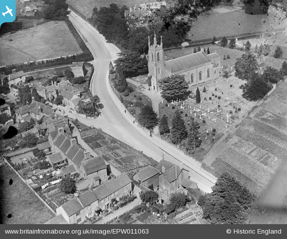
epw011063 ENGLAND (1924). Christ Church, Warminster, 1924
© Copyright OpenStreetMap contributors and licensed by the OpenStreetMap Foundation. 2024. Cartography is licensed as CC BY-SA.
Details
| Title | [EPW011063] Christ Church, Warminster, 1924 |
| Reference | EPW011063 |
| Date | July-1924 |
| Link | |
| Place name | WARMINSTER |
| Parish | WARMINSTER |
| District | |
| Country | ENGLAND |
| Easting / Northing | 387038, 144540 |
| Longitude / Latitude | -2.1855380954531, 51.199409915471 |
| National Grid Reference | ST870445 |
Pins
 SteveD |
Sunday 8th of January 2023 07:58:07 PM | |
 Class31 |
Friday 17th of May 2013 08:55:12 AM | |
Class31 |
Friday 17th of May 2013 08:53:58 AM | |
Class31 |
Friday 17th of May 2013 08:53:19 AM | |
Class31 |
Friday 17th of May 2013 08:52:58 AM | |
Class31 |
Friday 17th of May 2013 08:52:35 AM |