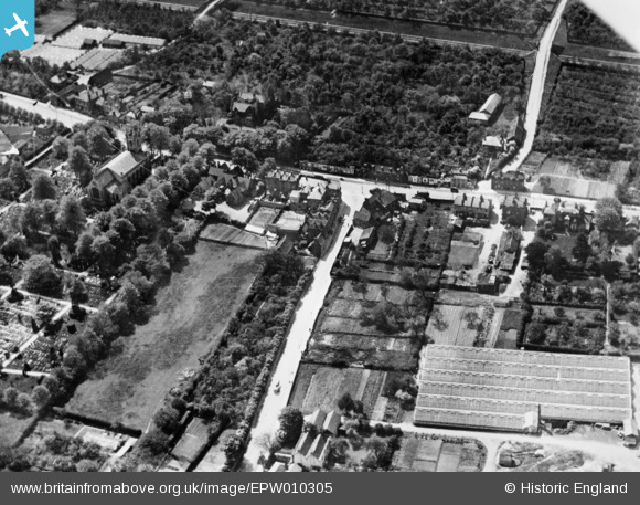
epw010305 ENGLAND (1924). The junction of Green Street and Hertford Road, Enfield Highway, 1924. This image has been produced from a copy-negative.
© Copyright OpenStreetMap contributors and licensed by the OpenStreetMap Foundation. 2025. Cartography is licensed as CC BY-SA.
Details
| Title | [EPW010305] The junction of Green Street and Hertford Road, Enfield Highway, 1924. This image has been produced from a copy-negative. |
| Reference | EPW010305 |
| Date | April-1924 |
| Link | |
| Place name | ENFIELD HIGHWAY |
| Parish | |
| District | |
| Country | ENGLAND |
| Easting / Northing | 535223, 197139 |
| Longitude / Latitude | -0.044931429444082, 51.65628531544 |
| National Grid Reference | TQ352971 |
Pins

Ray Flack |
Saturday 7th of November 2015 01:39:23 PM | |

Ray Flack |
Saturday 27th of September 2014 02:01:45 PM | |

Ray Flack |
Saturday 27th of September 2014 02:01:21 PM | |

Ray Flack |
Saturday 27th of September 2014 02:00:52 PM | |

Ray Flack |
Saturday 27th of September 2014 02:00:15 PM | |

Grk |
Monday 1st of September 2014 08:07:25 PM |


![[EPW010305] The junction of Green Street and Hertford Road, Enfield Highway, 1924. This image has been produced from a copy-negative.](http://britainfromabove.org.uk/sites/all/libraries/aerofilms-images/public/100x100/EPW/010/EPW010305.jpg)
![[EPW010304] Green Street, Enfield Highway, 1924. This image has been produced from a copy-negative.](http://britainfromabove.org.uk/sites/all/libraries/aerofilms-images/public/100x100/EPW/010/EPW010304.jpg)

