
Scheduled Maintenance
This website will undergo scheduled maintenance on Tuesday, August 6th, between 11:00 and 15:00, as well as on Thursday, August 8th, between 10:00 and 12:00.
During this time, services may be temporarily disrupted.
We apologise for any inconvenience.
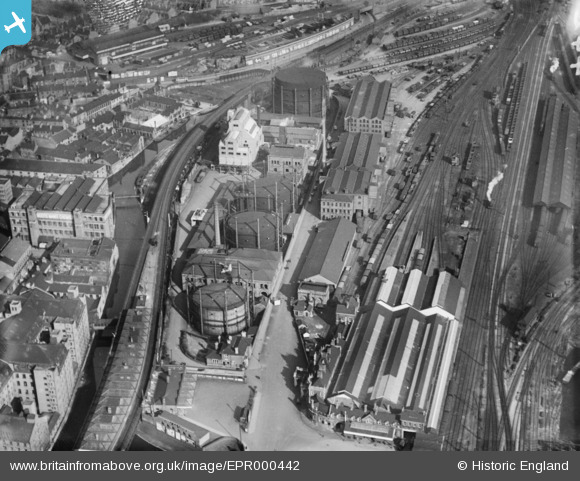
epr000442 ENGLAND (1935). London Road Station and the Eastcroft Gas Works, Nottingham, 1935. This image was marked by Aero Pictorial Ltd for photo editing.
© Copyright OpenStreetMap contributors and licensed by the OpenStreetMap Foundation. 2024. Cartography is licensed as CC BY-SA.
Nearby Images (10)
EPR000442

EPR000441

EPR000444

EPR000440

EPR000443

EPW053240

EPW053242

EPW013055

EPW008495

EPW008496

Details
| Title | [EPR000442] London Road Station and the Eastcroft Gas Works, Nottingham, 1935. This image was marked by Aero Pictorial Ltd for photo editing. |
| Reference | EPR000442 |
| Date | 26-March-1935 |
| Link | |
| Place name | NOTTINGHAM |
| Parish | |
| District | |
| Country | ENGLAND |
| Easting / Northing | 458079, 339359 |
| Longitude / Latitude | -1.1355178245386, 52.948152877943 |
| National Grid Reference | SK581394 |
