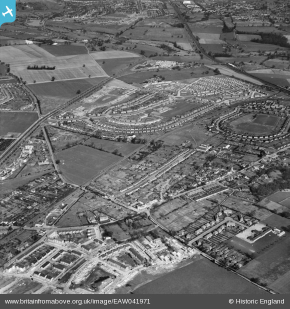
eaw041971 ENGLAND (1952). Development of the Birchwood area, Birchwood, 1952
© Copyright OpenStreetMap contributors and licensed by the OpenStreetMap Foundation. 2024. Cartography is licensed as CC BY-SA.
Details
| Title | [EAW041971] Development of the Birchwood area, Birchwood, 1952 |
| Reference | EAW041971 |
| Date | 14-March-1952 |
| Link | |
| Place name | BIRCHWOOD |
| Parish | HATFIELD |
| District | |
| Country | ENGLAND |
| Easting / Northing | 522318, 208976 |
| Longitude / Latitude | -0.22725685748646, 51.765631954041 |
| National Grid Reference | TL223090 |
Pins
 philmiller64@gmail.com |
Friday 30th of January 2015 04:07:51 PM |
User Comment Contributions
I grew up in Birchwood. |
 Janna |
Monday 9th of November 2015 09:15:06 PM |

