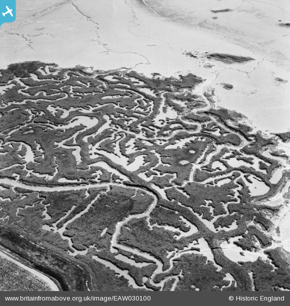
eaw030100 ENGLAND (1950). Part of Stoke Saltings near Stoke Creek Crossing, Stoke, 1950
© Copyright OpenStreetMap contributors and licensed by the OpenStreetMap Foundation. 2025. Cartography is licensed as CC BY-SA.
Details
| Title | [EAW030100] Part of Stoke Saltings near Stoke Creek Crossing, Stoke, 1950 |
| Reference | EAW030100 |
| Date | 5-June-1950 |
| Link | |
| Place name | STOKE |
| Parish | STOKE |
| District | |
| Country | ENGLAND |
| Easting / Northing | 582686, 174324 |
| Longitude / Latitude | 0.62876784985832, 51.437919680371 |
| National Grid Reference | TQ827743 |
Pins
Be the first to add a comment to this image!


![[EAW030100] Part of Stoke Saltings near Stoke Creek Crossing, Stoke, 1950](http://britainfromabove.org.uk/sites/all/libraries/aerofilms-images/public/100x100/EAW/030/EAW030100.jpg)
![[EAW030094] Part of Stoke Saltings near Stoke Creek Crossing, Stoke, 1950](http://britainfromabove.org.uk/sites/all/libraries/aerofilms-images/public/100x100/EAW/030/EAW030094.jpg)
![[EAW030093] Part of Stoke Saltings near Stoke Creek Crossing, Stoke, 1950](http://britainfromabove.org.uk/sites/all/libraries/aerofilms-images/public/100x100/EAW/030/EAW030093.jpg)