
Scheduled Maintenance
This website will undergo scheduled maintenance on Tuesday, September 10th, between 11:00 and 15:00, as well as on Thursday, September 12th, between 10:00 and 12:00. During this time, services may be temporarily disrupted. We apologise for any inconvenience.
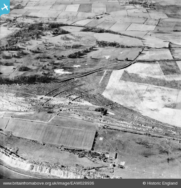
eaw028936 ENGLAND (1950). Ironstone Quarries to the south of Normanby Park, Flixborough, 1950
© Copyright OpenStreetMap contributors and licensed by the OpenStreetMap Foundation. 2024. Cartography is licensed as CC BY-SA.
Details
| Title | [EAW028936] Ironstone Quarries to the south of Normanby Park, Flixborough, 1950 |
| Reference | EAW028936 |
| Date | 5-May-1950 |
| Link | |
| Place name | FLIXBOROUGH |
| Parish | FLIXBOROUGH |
| District | |
| Country | ENGLAND |
| Easting / Northing | 489526, 415456 |
| Longitude / Latitude | -0.64610495792139, 53.627734997004 |
| National Grid Reference | SE895155 |
Pins
Be the first to add a comment to this image!