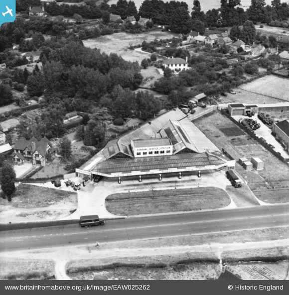
eaw025262 ENGLAND (1949). Denham Service Station, Denham, 1949. This image has been produced from a print.
© Copyright OpenStreetMap contributors and licensed by the OpenStreetMap Foundation. 2025. Cartography is licensed as CC BY-SA.
Nearby Images (7)
Details
| Title | [EAW025262] Denham Service Station, Denham, 1949. This image has been produced from a print. |
| Reference | EAW025262 |
| Date | 20-July-1949 |
| Link | |
| Place name | DENHAM |
| Parish | DENHAM |
| District | |
| Country | ENGLAND |
| Easting / Northing | 503749, 186634 |
| Longitude / Latitude | -0.50290313405871, 51.568545797552 |
| National Grid Reference | TQ037866 |
Pins
 Billy Turner |
Thursday 6th of October 2016 09:38:21 PM | |
 Billy Turner |
Thursday 6th of October 2016 08:05:53 PM | |
 Billy Turner |
Thursday 6th of October 2016 07:54:16 PM | |
 Billy Turner |
Thursday 6th of October 2016 07:49:44 PM | |
 Billy Turner |
Thursday 6th of October 2016 07:46:24 PM | |
 moses72 |
Wednesday 4th of November 2015 11:42:59 AM | |
 moses72 |
Wednesday 4th of November 2015 11:41:50 AM | |
 moses72 |
Wednesday 4th of November 2015 11:40:50 AM | |
 moses72 |
Wednesday 4th of November 2015 11:40:17 AM |


![[EAW025262] Denham Service Station, Denham, 1949. This image has been produced from a print.](http://britainfromabove.org.uk/sites/all/libraries/aerofilms-images/public/100x100/EAW/025/EAW025262.jpg)
![[EAW025263] Denham Service Station and Denham Avenue, Denham, from the south, 1949. This image has been produced from a print.](http://britainfromabove.org.uk/sites/all/libraries/aerofilms-images/public/100x100/EAW/025/EAW025263.jpg)
![[EAW025261] Denham Service Station, Denham, 1949. This image has been produced from a damaged negative.](http://britainfromabove.org.uk/sites/all/libraries/aerofilms-images/public/100x100/EAW/025/EAW025261.jpg)
![[EAW025265] Denham Service Station, Denham, 1949. This image has been produced from a print.](http://britainfromabove.org.uk/sites/all/libraries/aerofilms-images/public/100x100/EAW/025/EAW025265.jpg)
![[EAW025264] Denham Service Station, Denham, 1949. This image has been produced from a print.](http://britainfromabove.org.uk/sites/all/libraries/aerofilms-images/public/100x100/EAW/025/EAW025264.jpg)
![[EAW025267] Denham Service Station, Denham, 1949. This image has been produced from a print marked by Aerofilms Ltd for photo editing.](http://britainfromabove.org.uk/sites/all/libraries/aerofilms-images/public/100x100/EAW/025/EAW025267.jpg)
![[EAW025266] Denham Service Station and Oxford Road, Denham, 1949. This image has been produced from a print.](http://britainfromabove.org.uk/sites/all/libraries/aerofilms-images/public/100x100/EAW/025/EAW025266.jpg)


