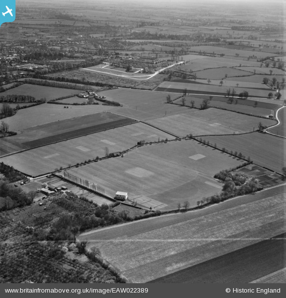
eaw022389 ENGLAND (1949). Bishop's Stortford College Playing Fields, Bishop's Stortford, from the north-west, 1949. This image was marked by Aerofilms Ltd for photo editing.
© Copyright OpenStreetMap contributors and licensed by the OpenStreetMap Foundation. 2024. Cartography is licensed as CC BY-SA.
Details
| Title | [EAW022389] Bishop's Stortford College Playing Fields, Bishop's Stortford, from the north-west, 1949. This image was marked by Aerofilms Ltd for photo editing. |
| Reference | EAW022389 |
| Date | 20-April-1949 |
| Link | |
| Place name | BISHOP'S STORTFORD |
| Parish | BISHOP'S STORTFORD |
| District | |
| Country | ENGLAND |
| Easting / Northing | 547411, 221307 |
| Longitude / Latitude | 0.14141213075901, 51.870390859542 |
| National Grid Reference | TL474213 |
Pins
 CarrieF |
Sunday 22nd of October 2023 11:10:13 PM | |
 Matt Aldred edob.mattaldred.com |
Monday 17th of October 2022 11:46:48 AM |


![[EAW022389] Bishop's Stortford College Playing Fields, Bishop's Stortford, from the north-west, 1949. This image was marked by Aerofilms Ltd for photo editing.](http://britainfromabove.org.uk/sites/all/libraries/aerofilms-images/public/100x100/EAW/022/EAW022389.jpg)
![[EAW022396] Bishop's Stortford College Playing Fields, Bishop's Stortford, 1949. This image was marked by Aerofilms Ltd for photo editing.](http://britainfromabove.org.uk/sites/all/libraries/aerofilms-images/public/100x100/EAW/022/EAW022396.jpg)