
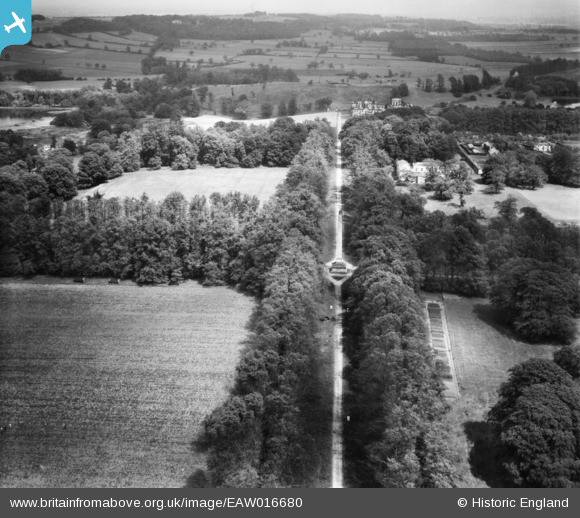
eaw016680 ENGLAND (1948). The Obelisk, Castle Howard, from the west, 1948
© Copyright OpenStreetMap contributors and licensed by the OpenStreetMap Foundation. 2026. Cartography is licensed as CC BY-SA.
Details
| Title | [EAW016680] The Obelisk, Castle Howard, from the west, 1948 |
| Reference | EAW016680 |
| Date | 23-June-1948 |
| Link | |
| Place name | CASTLE HOWARD |
| Parish | HENDERSKELFE |
| District | |
| Country | ENGLAND |
| Easting / Northing | 470893, 469946 |
| Longitude / Latitude | -0.91522736628074, 54.12030829201 |
| National Grid Reference | SE709699 |
Pins
Be the first to add a comment to this image!