
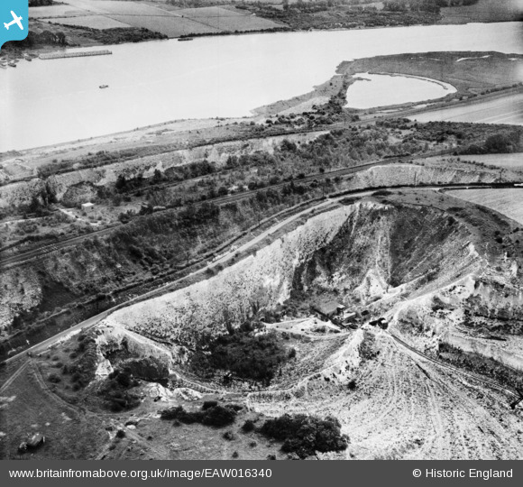
eaw016340 ENGLAND (1948). Chalk quarry next to Cuxton Road, Rochester, 1948
© Copyright OpenStreetMap contributors and licensed by the OpenStreetMap Foundation. 2025. Cartography is licensed as CC BY-SA.
Details
| Title | [EAW016340] Chalk quarry next to Cuxton Road, Rochester, 1948 |
| Reference | EAW016340 |
| Date | 9-June-1948 |
| Link | |
| Place name | ROCHESTER |
| Parish | |
| District | |
| Country | ENGLAND |
| Easting / Northing | 572410, 167815 |
| Longitude / Latitude | 0.4778892102217, 51.382662484782 |
| National Grid Reference | TQ724678 |
Pins
 Dylan Moore |
Tuesday 24th of December 2013 05:54:09 PM | |
Dylan Moore |
Tuesday 24th of December 2013 05:50:23 PM |
User Comment Contributions
The plant had previously gouged out the chalk between the two rail lines and between the rail and road. The final working face was off to the right. The plant had been idle during the war, and was re-commissioned in 1948. |
Dylan Moore |
Tuesday 24th of December 2013 05:57:10 PM |