
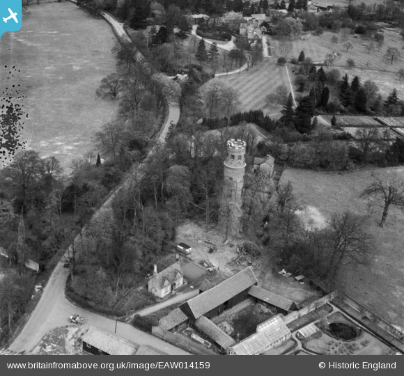
eaw014159 ENGLAND (1948). Stratton's Tower, Little Berkhamsted, 1948
© Copyright OpenStreetMap contributors and licensed by the OpenStreetMap Foundation. 2025. Cartography is licensed as CC BY-SA.
Details
| Title | [EAW014159] Stratton's Tower, Little Berkhamsted, 1948 |
| Reference | EAW014159 |
| Date | 7-April-1948 |
| Link | |
| Place name | LITTLE BERKHAMSTED |
| Parish | LITTLE BERKHAMSTED |
| District | |
| Country | ENGLAND |
| Easting / Northing | 529483, 208108 |
| Longitude / Latitude | -0.1237970683046, 51.756219638965 |
| National Grid Reference | TL295081 |
Pins
Be the first to add a comment to this image!