
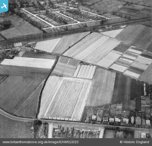
eaw013215 ENGLAND (1948). A plant nursery off Hersham Road, Hersham, 1948
© Copyright OpenStreetMap contributors and licensed by the OpenStreetMap Foundation. 2025. Cartography is licensed as CC BY-SA.
Details
| Title | [EAW013215] A plant nursery off Hersham Road, Hersham, 1948 |
| Reference | EAW013215 |
| Date | 11-March-1948 |
| Link | |
| Place name | HERSHAM |
| Parish | |
| District | |
| Country | ENGLAND |
| Easting / Northing | 511398, 164971 |
| Longitude / Latitude | -0.39940335346744, 51.372356956052 |
| National Grid Reference | TQ114650 |
Pins

hugh_mar |
Monday 24th of March 2014 07:29:52 AM | |
|
hugh_mar |
Monday 24th of March 2014 07:28:44 AM | |
|
hugh_mar |
Monday 24th of March 2014 07:26:49 AM | |
|
hugh_mar |
Monday 24th of March 2014 07:23:36 AM | |

Class31 |
Sunday 17th of November 2013 08:06:24 PM | |
|
Class31 |
Sunday 17th of November 2013 08:00:40 PM | |
|
Class31 |
Sunday 17th of November 2013 07:59:27 PM | |
|
Class31 |
Sunday 17th of November 2013 07:58:39 PM | |
|
Class31 |
Sunday 17th of November 2013 07:58:06 PM | |
|
Class31 |
Sunday 17th of November 2013 07:57:24 PM | |
|
Graeme |
Tuesday 12th of November 2013 07:52:37 AM | |
|
Graeme |
Tuesday 12th of November 2013 07:46:58 AM | |
|
Graeme |
Tuesday 12th of November 2013 07:46:30 AM | |
|
Graeme |
Tuesday 12th of November 2013 07:45:16 AM |
User Comment Contributions
This picture is taken looking North from Hersham Road to the railway, over what is now Coronation playing fields. Hersham Station is just off picture to the right. |
Graeme |
Tuesday 7th of January 2014 02:34:46 PM |
Thanks Graeme, what gave you the clue? We'll update the catalogue and post the new data here in due course. Yours, Katy Britain from Above Cataloguing Team Leader |
Katy Whitaker |
Tuesday 7th of January 2014 02:34:46 PM |