
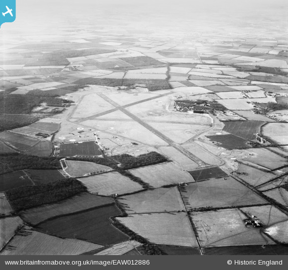
eaw012886 ENGLAND (1948). RAF Podington Airfield, Odell, from the north-east, 1948
© Copyright OpenStreetMap contributors and licensed by the OpenStreetMap Foundation. 2026. Cartography is licensed as CC BY-SA.
Details
| Title | [EAW012886] RAF Podington Airfield, Odell, from the north-east, 1948 |
| Reference | EAW012886 |
| Date | 19-January-1948 |
| Link | |
| Place name | ODELL |
| Parish | ODELL |
| District | |
| Country | ENGLAND |
| Easting / Northing | 496504, 260863 |
| Longitude / Latitude | -0.58662224238518, 52.237091259682 |
| National Grid Reference | SP965609 |
Pins
Be the first to add a comment to this image!