
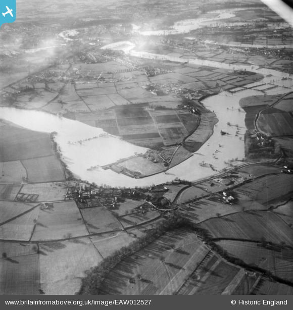
eaw012527 ENGLAND (1948). The River Severn in flood at Monkmoor, Shrewsbury, 1948
© Copyright OpenStreetMap contributors and licensed by the OpenStreetMap Foundation. 2026. Cartography is licensed as CC BY-SA.
Nearby Images (4)
EAW012527

EAW012624

EAW012528

EAW012623

Details
| Title | [EAW012527] The River Severn in flood at Monkmoor, Shrewsbury, 1948 |
| Reference | EAW012527 |
| Date | 14-January-1948 |
| Link | |
| Place name | SHREWSBURY |
| Parish | SHREWSBURY |
| District | |
| Country | ENGLAND |
| Easting / Northing | 352313, 313793 |
| Longitude / Latitude | -2.7060788691437, 52.719344462174 |
| National Grid Reference | SJ523138 |
Pins
Be the first to add a comment to this image!