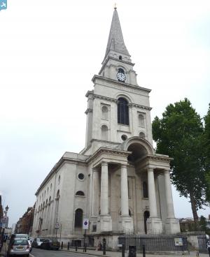
eaw011196 ENGLAND (1947). Bishopsgate Goods Station (Goods Yard), Christ Church and environs, Spitalfields, 1947
© Copyright OpenStreetMap contributors and licensed by the OpenStreetMap Foundation. 2024. Cartography is licensed as CC BY-SA.
Details
| Title | [EAW011196] Bishopsgate Goods Station (Goods Yard), Christ Church and environs, Spitalfields, 1947 |
| Reference | EAW011196 |
| Date | 30-September-1947 |
| Link | |
| Place name | SPITALFIELDS |
| Parish | |
| District | |
| Country | ENGLAND |
| Easting / Northing | 533727, 182031 |
| Longitude / Latitude | -0.072304665741012, 51.5208637298 |
| National Grid Reference | TQ337820 |
Pins
 The Laird |
Tuesday 23rd of October 2018 12:21:47 AM | |
 JP Bradford |
Wednesday 11th of July 2018 01:58:35 PM | |
 JP Bradford |
Wednesday 11th of July 2018 01:57:00 PM | |
 JP Bradford |
Thursday 8th of February 2018 11:26:05 PM | |
 JP Bradford |
Thursday 8th of February 2018 11:17:42 PM | |
 Class31 |
Wednesday 23rd of July 2014 12:05:07 PM | |
 Class31 |
Wednesday 23rd of July 2014 12:03:35 PM | |
 Class31 |
Monday 12th of May 2014 05:17:38 PM | |
 glennhughz |
Thursday 10th of April 2014 03:51:56 PM | |
 Alan McFaden |
Sunday 10th of November 2013 04:33:22 PM | |
 Alan McFaden |
Sunday 10th of November 2013 04:32:45 PM | |
 Alan McFaden |
Sunday 10th of November 2013 04:31:49 PM |


![[EAW011196] Bishopsgate Goods Station (Goods Yard), Christ Church and environs, Spitalfields, 1947](http://britainfromabove.org.uk/sites/all/libraries/aerofilms-images/public/100x100/EAW/011/EAW011196.jpg)
![[EAW011220] Bishopsgate Goods Station (Goods Yard), Commercial Street and environs, Spitalfields, 1947](http://britainfromabove.org.uk/sites/all/libraries/aerofilms-images/public/100x100/EAW/011/EAW011220.jpg)
![[EAW011140] Bishopsgate Goods Station (Goods Yard) and environs, Shoreditch, 1947](http://britainfromabove.org.uk/sites/all/libraries/aerofilms-images/public/100x100/EAW/011/EAW011140.jpg)
![[EAW011380] Bishopsgate Goods Station and environs, Shoreditch, 1947](http://britainfromabove.org.uk/sites/all/libraries/aerofilms-images/public/100x100/EAW/011/EAW011380.jpg)


