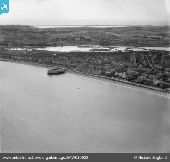
eaw010932 ENGLAND (1947). Melcombe Regis and Radipole Lake, Melcombe Regis, from the east, 1947
© Copyright OpenStreetMap contributors and licensed by the OpenStreetMap Foundation. 2024. Cartography is licensed as CC BY-SA.
Details
| Title | [EAW010932] Melcombe Regis and Radipole Lake, Melcombe Regis, from the east, 1947 |
| Reference | EAW010932 |
| Date | 24-September-1947 |
| Link | |
| Place name | MELCOMBE REGIS |
| Parish | |
| District | |
| Country | ENGLAND |
| Easting / Northing | 368460, 79910 |
| Longitude / Latitude | -2.4458700416575, 50.617459321136 |
| National Grid Reference | SY685799 |
Pins
 Class31 |
Tuesday 13th of October 2015 06:33:25 AM |


![[EAW010932] Melcombe Regis and Radipole Lake, Melcombe Regis, from the east, 1947](http://britainfromabove.org.uk/sites/all/libraries/aerofilms-images/public/100x100/EAW/010/EAW010932.jpg)
![[EAW010941] Melcombe Regis and Radipole Lake, Melcombe Regis, from the east, 1947](http://britainfromabove.org.uk/sites/all/libraries/aerofilms-images/public/100x100/EAW/010/EAW010941.jpg)
![[EAW010931] Melcombe Regis and Radipole Lake, Melcombe Regis, from the east, 1947](http://britainfromabove.org.uk/sites/all/libraries/aerofilms-images/public/100x100/EAW/010/EAW010931.jpg)
![[EAW010939] The town and countryside with Chesil Beach in the distance, Weymouth, from the east, 1947](http://britainfromabove.org.uk/sites/all/libraries/aerofilms-images/public/100x100/EAW/010/EAW010939.jpg)