
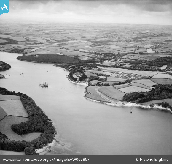
eaw007857 ENGLAND (1947). The Helford River with military remains associated with World War II, Helford Passage, from the south-east, 1947
© Copyright OpenStreetMap contributors and licensed by the OpenStreetMap Foundation. 2024. Cartography is licensed as CC BY-SA.
Details
| Title | [EAW007857] The Helford River with military remains associated with World War II, Helford Passage, from the south-east, 1947 |
| Reference | EAW007857 |
| Date | 22-June-1947 |
| Link | |
| Place name | HELFORD PASSAGE |
| Parish | MAWNAN |
| District | |
| Country | ENGLAND |
| Easting / Northing | 176893, 26773 |
| Longitude / Latitude | -5.1200485827902, 50.098450251556 |
| National Grid Reference | SW769268 |
Pins
 Twinotterpilot |
Tuesday 28th of February 2023 08:02:42 PM | |
Twinotterpilot |
Tuesday 28th of February 2023 07:59:25 PM | |
DKH |
Sunday 15th of January 2023 02:35:11 PM | |
redmist |
Tuesday 22nd of November 2022 08:07:49 PM | |
 Matt Aldred edob.mattaldred.com |
Friday 12th of March 2021 12:48:13 AM | |
Matt Aldred edob.mattaldred.com |
Friday 12th of March 2021 12:47:57 AM | |
CornwallPhil |
Monday 16th of June 2014 11:37:01 PM | |
CornwallPhil |
Monday 16th of June 2014 11:35:33 PM | |
cptpies |
Friday 6th of December 2013 11:07:04 AM | |
cptpies |
Friday 6th of December 2013 11:06:26 AM |
User Comment Contributions
 Pillbox and D-Day embarkation hard, Helford. |
cptpies |
Thursday 19th of December 2013 02:19:12 PM |