
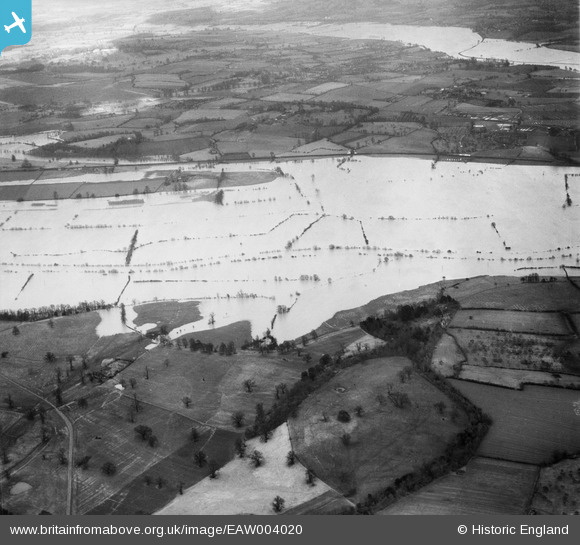
eaw004020 ENGLAND (1947). Flooding along the River Severn near Windmill Tump, Bushley Green, from the south-west, 1947
© Copyright OpenStreetMap contributors and licensed by the OpenStreetMap Foundation. 2026. Cartography is licensed as CC BY-SA.
Details
| Title | [EAW004020] Flooding along the River Severn near Windmill Tump, Bushley Green, from the south-west, 1947 |
| Reference | EAW004020 |
| Date | 21-March-1947 |
| Link | |
| Place name | BUSHLEY GREEN |
| Parish | BUSHLEY |
| District | |
| Country | ENGLAND |
| Easting / Northing | 386880, 235407 |
| Longitude / Latitude | -2.1912016267451, 52.016508939326 |
| National Grid Reference | SO869354 |
Pins
Be the first to add a comment to this image!