
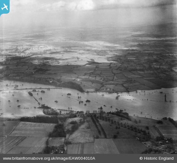
eaw004010a ENGLAND (1947). Flooding along the River Severn, Severn End, from the west, 1947
© Copyright OpenStreetMap contributors and licensed by the OpenStreetMap Foundation. 2024. Cartography is licensed as CC BY-SA.
Details
| Title | [EAW004010A] Flooding along the River Severn, Severn End, from the west, 1947 |
| Reference | EAW004010A |
| Date | 21-March-1947 |
| Link | |
| Place name | SEVERN END |
| Parish | HANLEY CASTLE |
| District | |
| Country | ENGLAND |
| Easting / Northing | 384916, 242703 |
| Longitude / Latitude | -2.2201455097545, 52.082061717693 |
| National Grid Reference | SO849427 |
Pins
Be the first to add a comment to this image!