
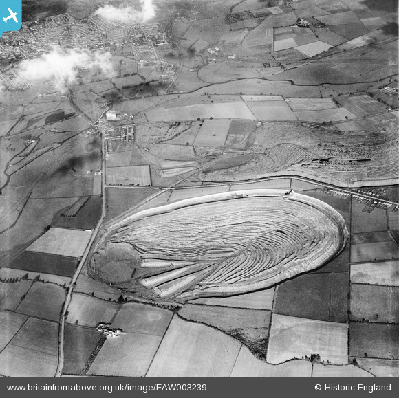
eaw003239 ENGLAND (1946). Irchester Ironstone Quarry, Irchester, 1946
© Copyright OpenStreetMap contributors and licensed by the OpenStreetMap Foundation. 2026. Cartography is licensed as CC BY-SA.
Details
| Title | [EAW003239] Irchester Ironstone Quarry, Irchester, 1946 |
| Reference | EAW003239 |
| Date | 28-October-1946 |
| Link | |
| Place name | IRCHESTER |
| Parish | IRCHESTER |
| District | |
| Country | ENGLAND |
| Easting / Northing | 490915, 265721 |
| Longitude / Latitude | -0.66714414992479, 52.281710933838 |
| National Grid Reference | SP909657 |
Pins

Ritchiet |
Tuesday 1st of March 2016 05:54:34 PM | |
|
Ritchiet |
Tuesday 1st of March 2016 05:50:43 PM | |
|
Ritchiet |
Tuesday 1st of March 2016 05:46:36 PM | |
|
Ritchiet |
Tuesday 1st of March 2016 05:33:29 PM | |
|
Ritchiet |
Tuesday 1st of March 2016 05:30:41 PM | |
|
Ritchiet |
Tuesday 1st of March 2016 05:22:55 PM |


