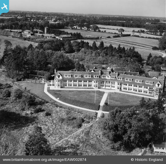
eaw002874 ENGLAND (1946). The East Anglian Sanatorium (Jane Walker Park) and the surrounding countryside, Nayland, from the south-east, 1946
© Copyright OpenStreetMap contributors and licensed by the OpenStreetMap Foundation. 2024. Cartography is licensed as CC BY-SA.
Nearby Images (7)
Details
| Title | [EAW002874] The East Anglian Sanatorium (Jane Walker Park) and the surrounding countryside, Nayland, from the south-east, 1946 |
| Reference | EAW002874 |
| Date | 1-October-1946 |
| Link | |
| Place name | NAYLAND |
| Parish | NAYLAND-WITH-WISSINGTON |
| District | |
| Country | ENGLAND |
| Easting / Northing | 595181, 234266 |
| Longitude / Latitude | 0.84189682949417, 51.972107076122 |
| National Grid Reference | TL952343 |
Pins
Be the first to add a comment to this image!


![[EAW002874] The East Anglian Sanatorium (Jane Walker Park) and the surrounding countryside, Nayland, from the south-east, 1946](http://britainfromabove.org.uk/sites/all/libraries/aerofilms-images/public/100x100/EAW/002/EAW002874.jpg)
![[EAW002876] The East Anglian Sanatorium (Jane Walker Park) and the surrounding countryside, Nayland, 1946](http://britainfromabove.org.uk/sites/all/libraries/aerofilms-images/public/100x100/EAW/002/EAW002876.jpg)
![[EAW002877] The East Anglian Sanatorium (Jane Walker Park), Nayland, 1946](http://britainfromabove.org.uk/sites/all/libraries/aerofilms-images/public/100x100/EAW/002/EAW002877.jpg)
![[EAW002873] The East Anglian Sanatorium (Jane Walker Park) and the surrounding countryside, Nayland, 1946](http://britainfromabove.org.uk/sites/all/libraries/aerofilms-images/public/100x100/EAW/002/EAW002873.jpg)
![[EAW002871] The East Anglian Sanatorium (Jane Walker Park) and the surrounding countryside, Nayland, 1946](http://britainfromabove.org.uk/sites/all/libraries/aerofilms-images/public/100x100/EAW/002/EAW002871.jpg)
![[EAW002875] The East Anglian Sanatorium (Jane Walker Park) and the surrounding countryside, Nayland, from the north-west, 1946](http://britainfromabove.org.uk/sites/all/libraries/aerofilms-images/public/100x100/EAW/002/EAW002875.jpg)
![[EAW002872] The East Anglian Sanatorium (Jane Walker Park) and the surrounding countryside, Nayland, 1946](http://britainfromabove.org.uk/sites/all/libraries/aerofilms-images/public/100x100/EAW/002/EAW002872.jpg)