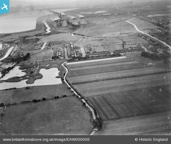
eaw000006 ENGLAND (1946). The Small River Lea, Brimsdown Power Station and environs, Enfield, from the north, 1946
© Copyright OpenStreetMap contributors and licensed by the OpenStreetMap Foundation. 2024. Cartography is licensed as CC BY-SA.
Details
| Title | [EAW000006] The Small River Lea, Brimsdown Power Station and environs, Enfield, from the north, 1946 |
| Reference | EAW000006 |
| Date | 24-January-1946 |
| Link | |
| Place name | ENFIELD |
| Parish | |
| District | |
| Country | ENGLAND |
| Easting / Northing | 536873, 199188 |
| Longitude / Latitude | -0.020288077318977, 51.674300018641 |
| National Grid Reference | TQ369992 |
Pins
 Sparky |
Friday 11th of August 2017 10:42:17 PM | |
 Ray Flack |
Saturday 7th of November 2015 11:08:28 AM | |
 Ray Flack |
Saturday 7th of November 2015 11:06:46 AM | |
 Ray Flack |
Saturday 7th of November 2015 10:52:35 AM | |
 Ray Flack |
Saturday 7th of November 2015 10:46:31 AM | |
 Ray Flack |
Saturday 7th of November 2015 10:33:15 AM | |
 Ray Flack |
Saturday 7th of November 2015 10:32:19 AM | |
 Ray Flack |
Saturday 7th of November 2015 10:30:36 AM | |
 Ray Flack |
Saturday 7th of November 2015 10:29:49 AM | |
 Ray Flack |
Saturday 7th of November 2015 10:28:57 AM | |
 Ray Flack |
Saturday 7th of November 2015 10:26:19 AM | |
 Ray Flack |
Saturday 7th of November 2015 10:24:44 AM | |
 Ray Flack |
Saturday 7th of November 2015 10:21:15 AM |


