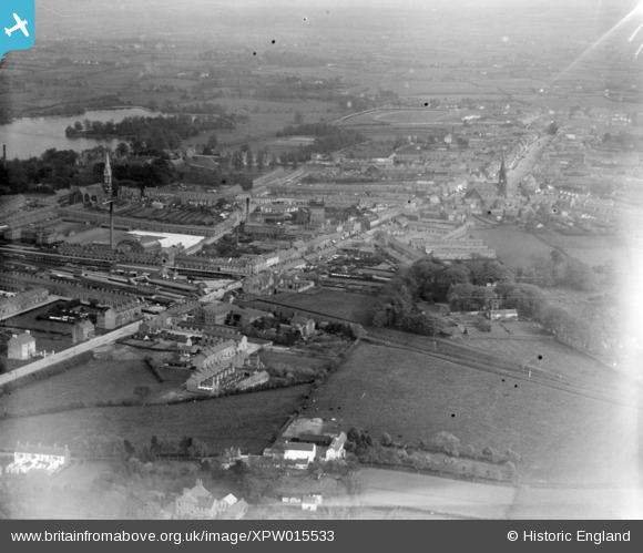
XPW015533 NORTHERN IRELAND (1926). General View, Lurgan, Craigavon, Northern Ireland, 1926. Oblique aerial photograph taken facing East.
© Copyright OpenStreetMap contributors and licensed by the OpenStreetMap Foundation. 2025. Cartography is licensed as CC BY-SA.
Details
| Title | [XPW015533] General View, Lurgan, Craigavon, Northern Ireland, 1926. Oblique aerial photograph taken facing East. |
| Reference | XPW015533 |
| Date | 3-May-1926 |
| Link | |
| Place name | LURGAN |
| Parish | NORTHERN IRELAND |
| District | |
| Country | NORTHERN IRELAND |
| Easting / Northing | 119120, 516501 |
| Longitude / Latitude | -6.336251, 54.465953 |
| National Grid Reference |
Pins
 Freebs |
Tuesday 21st of July 2015 03:06:43 PM | |
 Freebs |
Tuesday 21st of July 2015 03:06:21 PM | |
 Freebs |
Tuesday 21st of July 2015 03:05:58 PM | |
 Freebs |
Tuesday 21st of July 2015 03:05:04 PM | |
 Freebs |
Tuesday 21st of July 2015 03:04:10 PM |


![[XPW015533] General View, Lurgan, Craigavon, Northern Ireland, 1926. Oblique aerial photograph taken facing East.](http://britainfromabove.org.uk/sites/all/libraries/aerofilms-images/public/100x100/XPW/015/XPW015533.jpg)
![[XPW015535] General View, Lurgan, Craigavon, Northern Ireland, 1926. Oblique aerial photograph taken facing North.](http://britainfromabove.org.uk/sites/all/libraries/aerofilms-images/public/100x100/XPW/015/XPW015535.jpg)