
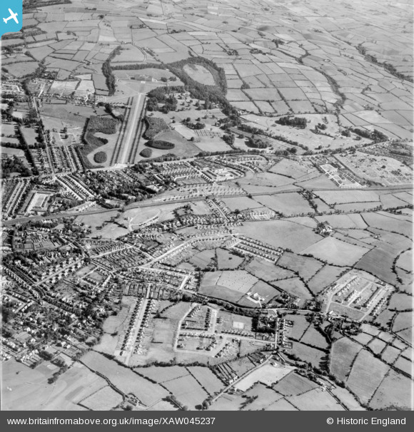
XAW045237 NORTHERN IRELAND (1952). General View, Gilnahirk, Castlereagh, Northern Ireland, 1952. Oblique aerial photograph taken facing North.
© Copyright OpenStreetMap contributors and licensed by the OpenStreetMap Foundation. 2026. Cartography is licensed as CC BY-SA.
Details
| Title | [XAW045237] General View, Gilnahirk, Castlereagh, Northern Ireland, 1952. Oblique aerial photograph taken facing North. |
| Reference | XAW045237 |
| Date | 1952 |
| Link | |
| Place name | GILNAHIRK |
| Parish | NORTHERN IRELAND |
| District | |
| Country | NORTHERN IRELAND |
| Easting / Northing | 152268, 528690 |
| Longitude / Latitude | -5.836282, 54.592503 |
| National Grid Reference |
Pins

IntrepidExplorer82 |
Thursday 31st of December 2020 10:02:56 AM | |
|
yourpete |
Friday 7th of November 2014 11:10:25 PM |